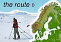
Distance 43m | Time 8.5hrs | Ascent 0m | Descent 0m
 I had been watching the weather forecast all day. It seemed there was a weather window of quieter weather from about 2300 onwards for a few hours before the southerly winds returned. After that the forecast made grim viewing with a small storm predicted in a couple of days. If I wanted to leave Berlevag it had to be tonight. By 2100 the flags in the town were hardly flapping anymore and by 2200 they were limp. I decided to go and after packing the kayak pushed of at 2300.
As soon as I was out of the harbour I met the northerly swell which had been building in the strong wind all day. The tide would be out in an hour but there was still a westwards ebbing flow, which would help me some of the way and hinder me the majority of it. The swell was massive with huge rollers coming out of the north. Some must have been a good three metres. With the lack of wind however they were smooth.
I decided to keep out of the mouth of the infamous Tanafjord and make a bee line for the north edge of the fjord on the west side at a place called Omgang. This way I hoped I could keep out of the worst of any wind or tidal streams. It was about 25 km.
The first part of the trip was down the coast along a coastal plain to the base of the steep Tanahorn mountain. By the time I reached it I was already a good few km offshore to the north, of it and could start to peer into the opening of the fjord. On the far side, now some 20 km away was the Nordkinn peninsula. I had a great vantage point to its classic plateau shape from here. It was a 300 metre high flat table top still covered in a fair bit of snow. Hanging from the side of this plateau like a curtain was a vast wall of cliffs.
The swell continued to come in from the north as I started across the fjord proper. There was a slight wind from the south east as forecast and this would help push me along. I was cruising over the fjord at 7 km per hour. It was not until I got to about half way did I start to relax and get a bit less apprehensive about being surprised by weather.
 The sky was clearing the whole time and when I was halfway across there was hardly a cloud in the sky. Unfortunately there was just a slither of it in the north so I could not see the midnight sun. I just see its glow on the clouds.
 Just after half way I noticed the wind which was a force two was now a three and had swung round to the south more. I was closing in on Omgang which was at the northern end of the base of the cliffs on the far side. I assumed the tide had turned by now and was flooding into the fjord and against the wind.
The more I paddled towards the base of the cliffs the more the wind increased. I still had about 4 km to go now and it was a force four. This worried me as there were numerous white caps everywhere, especially ahead. I think what was happening was the south east wind was being blocked by the huge line of 300 metre high cliffs which was channeling it northwards. The closer I got to the base of the cliffs the greater the funneling.
The last 3 km were hard. It was a force five with the waves nearly a metre high and breaking frequently. From the north the 2 metre swell was still continuing to pile in being carried by the tide. The tide itself was flowing into the fjord now and was causing the waves to become yet steeper. I paddled hard with a constant eye to my left to see when the larger waves were coming. The left side of my face was getting regularly showered in cold spray and my poggies were filling with water. It was about 0300 in the morning and the tide flowing into the fjord must have been going at full bore.
 After nearly an hour of powerful paddling I was at last getting through the worst of it and only had about half a km to go when I started to get some shelter from the southern wind and waves behind a prominentary. I was now out of the worst of the tidal flow. The hissing of the breaking waves and the wind slowly diminished until it was almost quiet. I then paddled into the small protected bay at Omgang to relax as the last 3 or 4 km were a hard fight. Had the wind strength gone up to a force 6 (12 m/s) I would have been at my limit.
I can now see why Tanafjord is not to be trifled with. There are geographical features which funnel the wind and increase it two or three fold, not least the steep cliffs. I was also told about the high wedge of Digermulfjellet mountain ridge which splits the fjord into two arms further down and this helps to accelerate any southerly winds. In addition there are the tidal currents which are at times quite considerable as inner Tanafjord is a large body of water which gets filled and empties every 6 hours. On the sea charts it is marked as an area with dangerous waves.
 Omgang was a relief. It was almost pastoral with 3 or 4 small cabins on a grassy peninsula. When I arrived 3 sea eagles took off and started circling. Sea eagles seem to be very wary and take to flight as soon as they spot humans. There was also a flock of about 20 reindeer near the beach. I wandered about stretching my legs and walked over to the small lighthouse before setting off again. It was about 0430 now.
Just to the north of the lighthouse at Omgang there was a strong tidal flow heading east. This was flowing straight into the larger swell coming from the north east. I had to tread a path through here avoiding the places where the swell was slowed so much it broke. I also had to paddle hard to make much progress. Slowly as I pulled my way up the coast here for a km the current diminished and I started to make progress.
The coastline of Koifjorden here was rocky with the occasional boulder beach. Beyond that were undulating hills covered in stones. There were a few valleys coming down from these hills. Down each valley came a strong wind and I again had to struggle up the coast. I could not go too far in as the northerly swell was breaking all the way along the coast here. There was a continual roar and many plumes of spray as the wind whipped the top back off the breaking crests.
 Having already felt exposed once in the wind this morning I was reluctant to cut across the open Koifjorden directly to Gamvik so followed the mentioned coastline for almost two hours until I approached some islands. I then headed north and with the force four wind behind me. I made quick time surfing the not quite metre waves for 8 km towards the landmark of a white church in Gamvik.
Gamvik was small with a population of just 200. It did however have a guesthouse in a large old wooden building. I spotted it as I came through the small breakwater and headed over. I got there at 0800 but the owner was already at work. His daughter phoned him and arranged a room before she headed off to school.
I retrieved the bare minimum from the kayak had a shower, drew the curtains and crashed out. I did not wake until 1730. When I got up the owner was back and we chatted. He was a nice and knowledgeable guy and prepared a tasty simple smoked cod meal. In the evening I watched the one football game a year probably worth watching. I then wrote the blog after this and did not get to bed until quite late. The weather forecast for tomorrow and indeed for the next few days is poor with gales and even a small storm so I will probably be here for a few days.
It had been an exciting day, or night rather, and I felt I had been tested a little. The kayak felt very good and performed well, but the rudder controls felt sluggish.
 It was only a force four in the morning but the forecast was for it to increase up to a force six later in the day and increase to a force seven in the evening. After breakfast I went for a walk around the town as it was dry.