Archive for July, 2009

Day 187. Kunna weather and rest day

Monday, July 6th, 2009

Distance 0km | Time 0hrs | Ascent 0m | Descent 0m

Day 187.1 My camp in the sheltered birch woods on a headland a few km south of KunnaDue to the late finish yesterday I did not get to bed until 0100 and slept through to 0900. When I woke the sun was blazing down onto the tent heating up the inside but I could hear that there was a good wind blowing. I looked outside and could see it was a force seven.

I had the writing to do from yesterday and with this wind the morning was the perfect opportunity. It took three hours. I had to do it in the tent to get some darkness as it was too bright outside. The weather continued to blow but the sun shone brightly. It was a classic high pressure wind. The same high pressure that enabled Patrick Winterton and Mike Berwick to paddle from Scotland to the Faroe Islands a couple of days ago. Well done lads on the 74 hour crossing!

After the writing the wind was still strong at around a force seven. There was plenty of shelter around the birch woods to lie in the sun and relax. I had not had the time or the weather to do this yet on the trip and this was a great opportunity.

Day 187.2 Looking from the headland back to Kunna across the force six seaThe grasses were now getting high and in this wind you could see swaths of them rippling as the gusts hit them. Where I was in a glade between the trees was almost still. Blackbirds and thrushes flew around in the birch and warblers darted from willow to willow. They were all spoilt now with the explosion of insects on these bushes and trees which was easily enough to rear a family of chicks.

Day 187.3 To the south of the headland was the relatively sheltered water across to the island of Meloy in the distant centreAfter a few hours I got bored and went for a walk. Firstly a few hundred metres to the west to the headland to see Kunna in the north west and what the sea looked like in that direction. It was now a force six in this open stretch of water and although the waves were small there were plenty of them breaking. I then went eastwards. There were a couple of nice beaches and a few leisure cabins lost in the woods. The sea here was more sheltered and it would have been possible to paddle south if I kept to the inside of the islands of Meloya and Amoya. My arms needed a rest and as I could feel one complaining last night.

Day 187.4 At the hamlet of Fore there were some old boat sheds along the coast.I kept on walking east and passed more nice cabins and boat sheds until I came to a lane. The fjord here was very beautiful and the cultural landscape with small farms and newly cut grass lying in the fields really gave me the impression summer was in full swing now.

Day 187.5 Many of the small farms at Fore were cutting grass in the fields as winter fodder for sheep who would be grazing in the birch forests all summer.I met someone and was told there was a shop some 3 km down the road. I set off down the lane to it. It took me through the hamlet of Fore and on to Reipa. There was indeed a shop and I bought some fruit, vegetables and juices and also a cooked chicken. I ate the chicken at the table in the shop while chatting to the shop assistant. Most shops in North and Rural Norway have a couple of tables with coffee and cake for customers to purchase and chat over. It helps fulfill a social need and is often a meeting place in these pub free communities.

After supper I walked the 5 km back to the tent along the lane and then the track through the birch wood. It was tracks through woods like this which I had skied just 4 months previously and it was eye opening to see them in their summer glory now with the forest floor full of wild flowers.

Back at the tent I managed to get an early night after the writing and should be ready for a reasonably early start tomorrow. I have nowhere in particular in mind but spoke with Tom Amundsen on the phone, who is also paddling Norway’s coast a couple of weeks ahead of me and he recommended Rodoy for its beauty.

It had been a good day. It is rare to get a rest day forced by the weather where one can still relax in the sun. My arms appreciated the rest and I was not bored cooped up in the tent sheltering from bad weather but could enjoy the sun and beautiful surroundings.

Day 186. Vag to Kunna

Sunday, July 5th, 2009

Distance 42km | Time 7.5hrs | Ascent 0m | Descent 0m

I slept well, woke early but fell back to sleep again and did not get up until 0830. It was yet another glorious day and the wind was very slight. The forecast said it should be a good force five which would build up to a force seven in the day. There was no sign of that.

After breakfast I found a small shed near the campsite and used for the passenger ferry which called occasionally. It had a table and chair so I unpacked the office here and wrote from 1000 until 1330. I was squandering good paddling weather but perhaps I needed the rest also.

By the time I finished the café opened at 1400. The food there was quite wholesome without a burger in sight. I had lunch here bought a little in the attached shop and then packed up the tent. I did not cast of until after 1600. The wind was still minimal and the weather fantastic.

Day 186.1 The pretty village of Lekanger is typical along the Norwegian fjord coastlineInitially I paddled past the neighboring village of Lekanger which looked typical fjord landscape with a pretty village surrounded by green fields and then impressive mountains rising above that. There were a few small islands here with sandy beaches and coves.

After passing Lekanger I headed off over to the island of Femris. I was going to go down the east side but the force four wind and choppy wavelets encouraged me to the top of the island where there was a beautiful channel between Femris and the smaller Rossoya to the north of it.

This channel opened out into a sheltered basin where there were a couple of lush farms above a quiet beach. The tide was low with a bit of shiny brown kelp leaf glimmering in the sun. It looked a good area for ducks but I did not see any. The basin then narrowed again into a channel and I paddled through it to the lee side of Femris island.

Day 186.4 Fugloy contained a couple of bird colonies and was probably home to all the puffins I sawTo my west was another larger craggy island with mountains up to 765 metres. It was called Fulgoy (Bird Island) and uninhabited. It almost certainly contained a couple of bird colonies as they were marked on the map and the sea was full of puffins, not in rafts but clusters of 10 or so.

Puffins spend all year in the ocean and return to land to nest and rear young in burrows on islands without mammal predators. They are excellent underwater swimmers and only need to fly in the summer months while nesting and bringing up the young. The rest of the year they are bobbing about in the Atlantic. Their wings and overall shape are therefore more suited to swimming and diving but they are OK fliers. On land, and whilst taking off and landing they are however somewhat clumsy.

When I approach they sometimes dive and sometimes fly. Those that fly beat their wings and splash across the waves with their feet splayed. They do not become airborne at once and crash from wave crest to wave crest until they finally bounce off one and are airborne. The red feet stay splayed like a BASE jumper until they have enough speed and then they tuck these take off aids together and accelerate. Once they are in the air they are fast, but not really acrobatic.

Day 186.2 Leaving Femris island with the spectacular coastline out to the mountain clump of Kunna on the rightI continued down the west side of Femris towards some very spectacular mountains along the edge of the coast here. Some of them rose steeply up for 1000 metres and there were many immense buttresses which almost gave an escarpment appearance. I paddled in the tranquil weather along their base having to lift my head back to see the tops. The slopes at the base of these cliffs were covered in birch forest before the rock rose up vertically. Unusually, much of the geological strata was horizontal. This was not because it was undisturbed, as this coast has seen violent geological forces at work twisting huge areas, but because of coincidence that these forces left them horizontal after twisting, crushing, stretching and bending them.

Day 186.3 Some of the fantastic rock buttresses soared some 700-800 metres  on the peninsula before FinnesI paddled along the base to Finnes at the end of these cliffs. I was going to land here for a stretch but there was a bit of a swell coming in from the west now and the shore was rocky. I saw a seal here. I have seen remarkably little seal and otter so far on this trip. Perhaps a hundredth of what I would see in Scotland on a comparable trip. This surprises me at the seas here are full of fish.

With the wind increasing slightly to a force three I paddled over the bay towards Grimstad and then veered towards the north side of Kunna. Kunna was a large clump of rock; a mountain on its own connected to the mainland by a sandy isthmus 2 km long and 400 metres wide. I could easily have portaged over the isthmus but I would have needed three trips with the gear and one trip with the kayak. About 3 km of walking; so perhaps an hour. Round the coastline it was perhaps about 6 km so also an hour. Also I did not want to portage on this trip, so paddle round it was.

I expected it to be quite choppy round the north of the Kunna peninsula. I was now at the very edge of Vestfjord and the shelter granted by the string of Lofoten islands was negligible. Indeed the other extremity of this fjord, the tip of the lobster’s claw on Moskenesoy at the end of the Lofoten Islands which enclosed the vast Vestfjord, was perhaps 100 km away now. It was essentially open ocean and the swell was almost 2 metres.

It did indeed get choppy with lots of rebound clapotis. As I approached the north west corner there was a skerry to go round. Here the swell was both meeting the final stages of the incoming tidal flow and was being influenced by underwater skerries. The wind was now a force five with spray flying everywhere. Claws of white sea were snapping at my kayak from all directions and occasionally one would break on it. It was like the rounding of Slettnes Fyr some 4 weeks ago in miniature.

The tide was against me and I paddled hard for a good half hour before I was through the worst of the unpredictable mayhem. Sometimes the waves were well over 2 metres and very steep also but luckily none of them caught me out. This was not the type of sea to anticipate anything so I was prepared to say goodbye to my hat should I have to roll. When I eventually started to get into quieter waters my mouth was not dry with fear as it had been at Slettnes Fyr but my jaw was clamped tight in concentration.

I then paddled into the bay on the south side of Kunna isthmus, where there would be a sandy beach, at around 2300. However it was a windswept place and the wind was a force 6 now with the occasional gust of seven. I therefore decided to continue south down 3 km of rocky coast to a headland which would offer protection. I did this and found a small beach with a flat grassy birch forest above it which was great for camping.

Day 186.5 The glow of the midnight sun on the very north of the islands of HelgelandskystI put the tent up here and enjoyed the view southwards. It was of the Northern parts of the very picturesque Helgelandskyst, and it was basking in the glow of the midnight sun. Helgelandskyst is the next stage and it is reputed to be the best bit of the Norwegian coast and one of the top five kayaking destinations in the world. It is a mass of some 20,000 islands which offer beaches and protection. I have been looking forward to it for ages.

Day 186.6 There were many orchids and other flowers in the woods where I camped sheltered from the windIt had been a nice day with the benefit of some excitement at the end. There was a lot of dithering and writing in the morning but the kayaking was great. It would certainly have been easier to portage over Kunna isthmus – but not as sportif.

Day 185. Kjerringoy to Vag

Saturday, July 4th, 2009

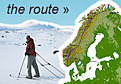
Distance 59km | Time 10.5hrs | Ascent 0m | Descent 0m

Day 185.1 The island of Landegode of the coast from Bodo has  many sea eaglesI had a tremendous sleep in a comfortable in the complete dark. It is rare is seen darkness at the moment. I woke at 0700 and had the breakfast the guesthouse provided. Then I packed up the few belongings in the room, looked at the sea full of white horses from the balcony and went down to the kayak. It was a breezy day with a northeasterly force five at least. But it would be directly behind me.

I set off at 0930 and paddled out of the harbour breakwaters. It was not as bad as it looked and I could hug the coast for much of the way. There was quite a small fetch to the north so the waves were not large at about a metre, but many were breaking.

Out to the west was the steep island on Landegode. It was very craggy. One of Scotland’s most craggy islands, Rhum, would have been comparable in size but Rhum would have looked flat beside it. And Landegode was just one of hundreds of such islands in Norway! I draw this comparison because I think it was from Landegode that the sea eagles which were reintroduced into Scotland and placed on Rhum some 30 years ago came from this island.

Day 185.2 Looking east up the classic fjord shaped MistfjordAs I came down the coast there were a few headlands to go round where the sea was pretty bumpy but there were also a few islands to find shelter behind. When I reached Mistfjord I could cut across the mouth outside the islands as I was largely protected from the infant swell by the group of small islands and islets which almost formed a peninsula near Fjaere. Looking up Mistfjord showed some classic fjord scenery with a U shaped valley, now flooded with the sea and steepening birch forest rising above this to the steep slopes of bare rock and alpine peaks around 1000 metres obscured by vanishing cloud.

As I entered the sound of Landegofjorden between Landgode island and the mainland the wind increased up to a force six. It was still behind me and I was getting blown along at a tremendous rate sometimes. The waves tented to slow me down as although I could surf down the occasional one I was also sliding down the back of the wave passing under me into the trough. The waves where going at least twice the speed I was. This resulted in a wallowing motion of stopping and starting. If I caught a good surf wave I was doing 12 km an hour for a burst.

Day 185.3 The sandspit at the eand of the peninsula by Mjellfjellet mountainI came to one peninsula, south of Mjellefjell mountain, with a rocky islet at the end separated from the rest of the peninsula by a sandy spit. I stopped on the spit and the rising tide soon covered the spit allowing me enough time to stretch. With a good force six now blowing I was fortunate to find shelter south of this peninsula with a group of low grassy islands grazed by cows at Vagoy.

After this I approached Bodo. There was village on the outskirts called Skivika and a steep hill called Bratten. There was no protection here from the one and half metre waves. There waves were hitting the base of the cliffs on Bratten and rebounding causing erratic clapotis. In addition to this there were a small tidal current and the force six wind blowing the spray off the crests. It was a very choppy, bumpy sea with masses of drama. I was now thankful for my load lugging barge as it was extremely stable in such seas and looked after me well without too many support strokes. It was the Volvo of kayaks. I thought of the girls in their hard chinned sports cars who maybe passed by earlier.

After this I was into a sound with the diminishing sea behind me, Hjartoy to the west and the unfolding urban scenery of Bodo to the east. The trouble with large towns is that it is difficult to find places to land near somewhere to stay. Then you have a 100 kg kayak and contents to deal with and secure and inevitably a way to walk to the accommodation. It was quite a palaver in Tromso. It looked ever worse here. Outside of towns you have the relatively stress-free option to just ram the kayak up the beach, put up the tent and carry the empty kayak up above the high tide.

Bodo was second only to Tromso as the largest town in North Norway and was a fast growing town with 40,000 inhabitants. It looked like it had a nice centre in a very secure harbour as I paddled past the mouth of the harbour. There werte many nice buildings, mostly new, along the harbour front together with the expensive chain hotels like Rica and Radisson. Much of old Bodo was destroyed in the war.

Day 185.4 The Hurtigruten ferry Nordlys goes at a tremendous speedI was about to cross the harbour mouth when the Hurtigruten ferry streamed out. It was one of 13 boats which take 11 days to do the Bergen-Kirkenes-Bergen run with a northbound and southbound ferry passing each of the 25 odd ports each day. Today’s ferry was the Nordlys. The one I had a near encounter with at Berlevag some 5 weeks ago. I wonder if it recognized me.

I paddled right past the whole of Bodo and was thinking to go round the peninsula and up Saltfjord to camp at an official campsite near the shore. It was a bit too risky to cross the open 10 km Saltfjord in this force six wind. However as I came to the tip of the peninsula I noticed that the wind had dropped off to a force four and that the sea was more protected. I stopped among some islets, ate a late lunch and considered the options. The girls had reached Bodo at 0900 and called it a day here and were lucky with a campsite in the main harbour area.

Just 20 km up the Saltfjord was a narrows and then after the narrows the Skjerstadfjord. The incoming and outgoing tide have to pass through these narrows to fill up and empty Skjerstadfjord. The height difference can be a metre. The resulting tidal flow is the strongest in the world and I have heard people say it reaches 40 km per hour. There are many eddies and whirlpools as the tide reaches its maximum flow every 6 hours and then a short period of calm water as the currents change direction.

I decided to cross the Saltfjord while the going was good given the forecast for the next days with strong north winds. As I was about to go a large Nordlandsbat went sailing past. The Nordlandsbat is a traditional wooden boat from this area. They come in many sizes. It is perhaps the most graceful boat afloat with it high bow and stern. It uses a large square sail, the canvas of which later provides the shelter at the front boat when it is anchored or in harbour. This one was large, about 40 foot, and went by under a square sail at a tremendous speed and looked like something out of the Viking era.

Day 185.5 Crossing Saltfjord with Sandhornoya in the photos centre on the south sideThe crossing was easy. With the good wind I made very good time and the waves never really built up. It took just over an hour before I was approaching the other side. I did not land here but veered off to the west passing to the north of some flat islands and heading to the light house on the tip of a peninsula north of Marnes. This would mean I would be in the protection of islands for the first half of the next leg to Kunna.

Day 185.6 The very picturesque village of Lekanger on Sandhornoya was next to the village of VagI rounded the lighthouse and then started down the sound with the wind behind me. I didn’t really pass any beaches on this rocky coast until I had done some 5 km and reached the village of Vag. There was a harbour, beach, closed shop and campsite here. It would do nicely as it was nearly 2030. Despite the distance today I did not feel tired mostly due to the following wind.

I put up the tent when a guy approached from a large group of 30 odd people. As usual in North Norway it was a friendly hospitable visit and he invited me to supper. We chatted a bit and he was the rescue winchman in a rescue helicopter based in Spitsbergen. I went over to the group who were all from Fauske small boat club and had come here in their boats for the evening. They were grilling and all in good spirits. I was given a lot of food and tried to join the conservation but it was too fast and I was too tired to concentrate on the dialect.

After a great dinner we all went down to the old Nordlandsbat which some of them had sailed from Fauske. It was a Fembøringen, the largest of these splendid boats. The square sail was down over the front of the boat in a tent type arrangement and some 20 people gather underneath with guitars and healthy voices. It was a nice evening. After chatting with the guardian of this community owned boat and learning something about their history I had to excuse myself to write the blog as it was already midnight and the sun was now just kissing the horizon. However once in the tent I could not face the blog and crashed out soon after.

It had been an excellent day again and it was nice to have a bit of excitement after the beautiful but placid sounds of Troms and the quiet weather of the last few days. It continued to be an exceptionally dramatic area with islands and skerries and then very steep mountains.

Day 184. Holkstad to Kjerringoy

Friday, July 3rd, 2009

Distance 48km | Time 8.5hrs | Ascent 0m | Descent 0m

Day 184.1 The glow of the sun highlighting the mountains of the alpine island of AustvagoyaI woke quite early at about 0300 and I surprised myself by getting up at once and having breakfast. I was packing my stuff and taping up some possible leaks in the kayak before girls were stirring in their tent.

As I was going about my tasks at 0330 there was perhaps the best skyscape I have seen on this trip. The sky was dark except for a bright orange strip which silhouetted the saw like profile of the mountains on the Lofoten island of Austvagoya.

When the girls did emerge around 0400 they broke camp and packed their kayaks with a well practiced efficiency. They were surprised to see my up as I said I would write the blog and probably get up later.

It was a dull overcast morning with just a slight northerly wind. The glow over the Lofoten Islands had gone out. These two girls banter and good spirits would brighten up the dullest of mornings however.

We push off from the sandy beach at 0500. They set the pace in their narrow streamlined kayaks and I paddled hard in my stable load lugging barge. With the wind behind us we made incredible time and already by 0700 had done nearly 15 km.

Headland after headland zoomed by with ruthless efficiency. I stopped to take a photo and was suddenly 100 metres behind. We spotted moose on one of the islands in the pretty archipelago to the west Skotstind. This mountain was at the west end of the typically steep and dramatic peninsula which ended in this troll like peak before plunging into the still sea and patchwork of island and sandy channels. Moose out here really surprised me, although they are good swimmers.

Day 184.2 The Swedish Girls, Klara and Evelyn, leaving Vettoy in the south east corner of SteigenAfter another two quick hours of fast paddling we reached Vettoy on the very south east of the Stiegen peninsula. It was barely 0900 and we had already done 30 km. The next part of the journey was crossing Folda, which was a 16 km wide fjord. We pulled up on the beach and enjoyed the sun as the clouds peeled away.

However unlike the exposed fjord crossings of Austhavet and Ishavet, Folda fjord had numerous islands and skerries in a line across its mouth. I later discovered that most of these belong to a Nature Reserve due to its prime bird habitat.

Day 184.5 The very spectacular mountain of Eidetind, 1040m, taken from Helloya in Folda fjordWe hopped from island to island with the sun getting higher and warmer. We shot past Helloya and paddled over to Karlsoy. I took a few photos here, most notably of the claw like Eidetind, 1020m, with its massive and vertical south face and fell behind, but the girls waited occasionally and we paddled on chatting.

At Karlsoy we stopped paddling for the goodbyes. I was heading over to Kjerringoy to hopefully find a room to wash cloths and myself, charge batteries and eat some vegetables. The map indicated a pensionat existed there but it was often wrong. Evelyn and Klara were continuing south for another 10 km to camp.

Day 184.3 The Swedish Girls with Eidetind mountain in the backgroundWe paddled off in our different directions. I cannot help but admire their discipline and determination. Their policy of very early start meant a very early finish and they would probably already be camped and relaxing at 1400 with 50 km in the bag. At the same time this was not done with dogmatic rigidity and there was plenty of time for banter and fun. I could not manage the early starts on a regular basis as the writing often takes so much time I seldom get to bed before midnight and tend to relax in the mornings before I start.

I crossed the remaining 5 km to Kjerringoy and rounded the harbour breakwater to find a marina full of expensive yachts. It seemed Kjerringoy was a haven for the sailing fraternity to come and relax in. It was a very prosperous community. There was a guest house but it looked expensive. I tried my usual line of saying I was kayaking Norway’s coast and it often seemed to get me a massive reduction. It did again here.

The place was perfect and the room was great with power sockets everywhere and a balcony over the marina where I could hang cloths to dry. They let me use the washing machine for free and went out of their way to be helpful and interested. By 2300 the cloths were dry, all the writing was up to date, all batteries were recharged, I was clean and ready for a 0900 start tomorrow, and by which time the girls will already be past Bodo.

Day 184.4 A self portrait after half  a year on tourIt had been another fantastic day. The early start was great in retrospect and it meant I had done a good day by 1330. I did not linger around the islands or photograph as much as I wanted but that was the price for the masses of free time in the evening. Having such good company for the first half of the day was also great. The guesthouse was also superb and tremendous value for money. It would be the first time I was not in my sleeping bag for 2 weeks.

Day 183. Buvag to Holkstad

Thursday, July 2nd, 2009

Distance 41km | Time 9.5hrs | Ascent 0m | Descent 0m

Day 183.1 Paddling down the west side of Hamaroy with the mist lifting to reaveal a jungle of birchI woke quite early at about 0500 as I expected the two Swedish girls to paddle past and drop in around 0700 as they tried to do yesterday. So I was ready to paddle with them when they arrived. It was an overcast but still morning with mist lingering on all the peaks.

When the girls did not show I phoned them. They had just gone past a half hour previously and could not see me. We arranged to meet for lunch at a place they would stop. I set off paddling around 0730.

It was an easy paddle on the still sea, but much of the scenery was obscured still by the low cloud, however it was lifting fast and the sun was breaking through in places. Here and there a mountain ridge on this wild west side of Hamaroy would break free of the mist.

Day 183.4 Looking to the interior of Lundoya island beyond Fjetterstad beach reminded me of tropical islandsHamaroy is where one of Norway’s best known writers, Knut Hamsun, grew up and the wild landscape here must have influenced his psyche. The mountains here were high and steep and were covered in a thick birch forest which made them look like a tropical jungle. There were only a few beaches on this dramatic and, apart from Buvag, uninhabited west side of the island.

Day 183.2 The beautiful sandy beach at Fjetterstad on Lundoya islandI had to wait for a ferry to go past before I crossed the short Okssundet to the island of Lundoya. There were a few puffins about and it was easy to spot them at 500 metres so still was the day. Lundoya carried on in the same theme as Hamaroy with very steep mountains covered in the jungle of birch. There were a few beaches here and one half way down the west side was stunning. It was called Fjetterstad

Day 183.3 The beach at Fjetterstad on Lundoya island with the abandoned homestead on the islet in the bayIt was set in a bay with a lush island with an abandoned farm one it. The side of the island facing the bay was covered in white sand and grassy skerries where many hundreds of terns were nesting. The farm was derelict but in its day, in the summertime it must have been a near paradise. Across the green water of the sandy bottomed bay was a half km beach of near white sand. Behind the beach rose the steep ridges covered in birch jungle. It looked like and was becoming as hot as something from Mauritius or Caribbean but was empty. I landed here for a quick stretch and to soak up the beauty.

As I was leaving a text came through from the Swedish Girls. They were some 7-8 km ahead on Gasdussan and were cooking lunch. My route initially took me across a small sound and into an archipelago of small islands north of the larger island of Engeloya. These small islands were quite rocky but with a lot of grass here and there. Some farmers had moved sheep and goats onto them to graze in peace through the summer. Most of the islands had a brilliant white beach. A few were connected at low tide by these very white sands.

Day 183.5 Looking up the west coasts of Engeloy, then Lundoya and finally Hamaroy at the coasttal fringe and mountainous interiorsRight on the very northern tip of Engeloya, at a place called Hamnvika, was a idyllic old fisherman’s robuer or cabin with white beaches and turquoise waters all around the bay formed by the islands. It was a picture postcard place. The whole coastline here was a mantle of islands and farmed land with very steep mountains rising nearly a 1000 metres just inland. All the mountains were very sharp and spectacular.

From Hamnvika at the tip I crossed an open bay to the next headland called Gasdussan. There was a tidal island here with sheep wandering across the sand from the main Engeloya island to take advantage of the rich grass. The Girls were waiting on a beach here. As I pulled up I got a warm welcome.

The Girls, Evelyn and Klara, were two young Swedish girls in their mid 20’s. They had kayaked around Sweden’s coast last year and now this year were doing Norway’s coast. They started some 3 weeks behind me and although they had taken a slightly different route saving about a week they had managed to catch up by putting in many huge days.

As we had lunch under a rowan tree beside the foundation stonework of a long gone farm building we chatted a lot about the trip. We had met and stayed with many of the same people and paddled much of the same waters. It was an enthusiastic chat for a good two hours.

They aimed to do 50 km each day and had already done 40 this morning. So they were looking for another 10. We carried their heavy boats down the beach to the low tide and set off. The chat and banter continued in the kayaks.

As we rounded the blunt peninsula we entered another archipelago of small islands. There were sandy beaches everywhere again and a few of the islands had old summer farms on them which were now leisure homes for the children or grandchildren of the last farmer.

One of the islands, Lauvoya, was an old small scale trading hamlet. It was perhaps the largest island in this group. It still had a prosperous looking farm surrounded by mature deciduous trees and a very large warehouse on the jetty. This farm was set in lush green fields and a short distance away was a sandy spit to an islet surrounded by a white beach. It was a serene setting.

It was now late afternoon and we decided to find somewhere to camp. As we emerged from one of the many channels between the islands we spotted a large white beach about 2 km away to the south east by the village of Holkstad. There was immediate consensus to make for it and camp there.

Within half an hour after landing the tents were up between the usual red boatsheds and we were chatting on the grass for another few hours. I cooked outside in the sun for a change in the still evening. The odd mosquito was a pest. The girls prepared for bed very early and by 2030 they were heading to their tent; and this was a late night for them! They were getting up as usual at 0330 to be on the water for 0500.

I still had the blog to do. I inserted the last of the 4 laptop batteries to find it was dead. I only had a few minutes of power left. I down loaded the pictures in case I dropped the camera and looked at the map for somewhere suitable to charge the all the batteries tomorrow. Kjerringoy some 50 km to the south looked good. I crashed out at 2100 and prepared myself for a Swedish start.

It had been a great day. Fantastic scenery, great weather and the good company of two witty, smart, bold Swedish Girls.