Day 229. Stavanger to Hatangen in Ha
Posted by: James on August 17, 2009Distance 39km | Time 8hrs | Ascent 0m | Descent 0m
 I slept well and was up at 0700 so I could see the Oyvind before he went to work and the kids before school. I had also arranged to meet Tom at 0800. Tom would give me a hand carrying the stuff to the beach and see me off. The weather however did not look promising with a good force 5 still and frequent showers.
Tom arrived at 0800 and we chatted for a good hour before I started to get things ready during this time the weather was easing a bit. Eventually at 0930 we put the drybags in the wheelbarrow which Elin pushed to the shore while Tom and I carried the kayak. After a heartfelt goodbye I said paddled out of the bay at 1000. My thoughts as I entered the fjord were how nice the Amundsen family was and how good they had been to me. We will keep in touch I am certain.
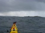
 I paddled across Hafrsfjord and negotiated some skerries to get into the open sea. The wind was now just a force four but the force six over the last 2 days had left the legacy of a large swell. Once I was past the skerries the swell must have been around 2.5 metres. I headed south and paddled down the coast with the new offices of the oil industry at Tananger on my east and the old lighthouse on the islet of Flatholmen on my west. I then crossed the mouth of the deep Risavik bay to reach another headland.
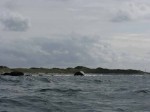
 Tom had warned me about a feature on the coast and that was the shallow boulder ridges stretching out from every point. I could see what he meant. Most of the coast here was sandy beach but between the beaches were headlands of large glacial boulders. These headlands gradually descended into the sea and beyond. Often there were boulders nearly a km from the shore out from the headlands. As the swell passed over the boulders it rose into high waves and then crashed around the boulder. In this swell I had to be on the lookout the whole time and make some detours around the headlands.
I soon crossed Sola bay with its huge sandy beach of very light sand and then reached Olberg on the south side of it. Again I had to make detours here to avoid eruptions in the sea caused by visible and unseen submerged boulders toppling the swell. I needed to stop soon afterwards for a pause and to prepare myself for the next stretch which was Jaerens Rev, an infamous stretch of coast. I changed paddles to the larger blade and clipped myself to the kayak and attached the paddle leach.
While I was resting at Hellersto I went to take some photos of the sea crashing onto the rocks outside the harbour. The camera fell out of my pocket and into a rock pool. I retrieved it but it had already drowned. The card was OK though. The camera I use is not waterproof but has a good lens compared to the Olympus waterproof one. However I cannot get good action shots as I have to open up the day hatch to get the camera. Luckily I had the foresight to anticipate the camera would get wet and have two of the same.
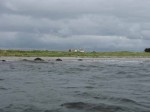
I left Hellersto and once more headed back into the swell. There was the roar of breaking surf along the coast here as this swell formed waves and they dumped onto the beaches. I passed a shipwreck here which showed how bad this coast can be. In fact there were a few wrecks here. They seemed to be almost as common as in Finnmark. However here they were still along the shore, while in Finnmark the huge boats were hurled high onto the rocks.
All along the shore here, behind the beaches, sand dunes and boulders was the most productive farmland in Norway. The farmers here were rich. The huge barns where large herds of dairy cattle were milked and spent the night had traditional tiles on the roofs and the farm houses were traditional but large with many embellishments like balconies and rows of dormer windows in the mansard roofs. Around the farms where lush fields of grass and large herds of cattle. Jaeren was synonymous with farming.
 I approached Jaerens Rev with some trepidation. As I headed down Borestranda beach I was heading further and further along a peninsula which jutted into the North Sea and its swell. The map marked an area of dangerous waves here and I could see a boulder ridge extending into the sea and then surf where this ridge was submerged. However contrary to my expectations the swell did not increase and was still 2.5 metres. Indeed if anything it diminished slightly.
 I passed the peninsula quite easily and was never concerned by the conditions. Once I returned to the shore after detouring round the boulder ridge the sea became much calmer and it became a pleasant evening. I paddled along the beach at Orrestranden which is Norway’s longest at about 5 km. There were some large waves breaking along the beach and I would not have been comfortable landing the fully laden kayak through them.
By the time I got to the end of this beach it was 1700 and I was looking for somewhere to camp and do some writing. There was however nowhere which was easy to land, looked nice to camp at and most importantly would not trap me if the wind increased in the night and the surf was too big in the morning.
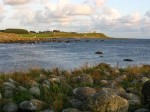
I paddled past Skeie and Naerland and then started heading out round a peninsula again when I saw some boatsheds on a grassy pasture with some tables nearby. It looked ideal and it was sheltered also as it was in a spit of land and the sheltered side was the Haana river estuary. I paddled up the estuary for 200 metres passing a group of some 20 swans and landed on grass. I got out and had the luxury of dragging the fully loaded kayak straight up the meadow to a campspot.
 It was a windy evening but I found a table in the lee of a boatshed. I put up the tent to dry, cooked supper, processed the photos and watched the fly fishermen hoping for salmon, but by 2100 I could just not start to write. As darkness approached it started to rain and I gave up and went to bed at 2230.
It had been an excellent day. The paddling was interesting and the scenery was a nice change. The big beaches the flat coast and the big farms in green fields reminded me very much of the land just over the sea from here; namely the coast around the north east of Scotland.