Day 159. Svaerholt to Tones
Posted by: James on June 8, 2009Distance 55km | Time 12hrs | Ascent 0m | Descent 0m
 The weather in the morning was not quite good enough to tempt me to start paddling. In addition I needed a morning to catch up with the blog and together with the cold force three northwest wind and the occasional light sleet shower it gave me a reason to stay put and see what happened in the afternoon. The last forecast I saw was that it would improve towards the evening.
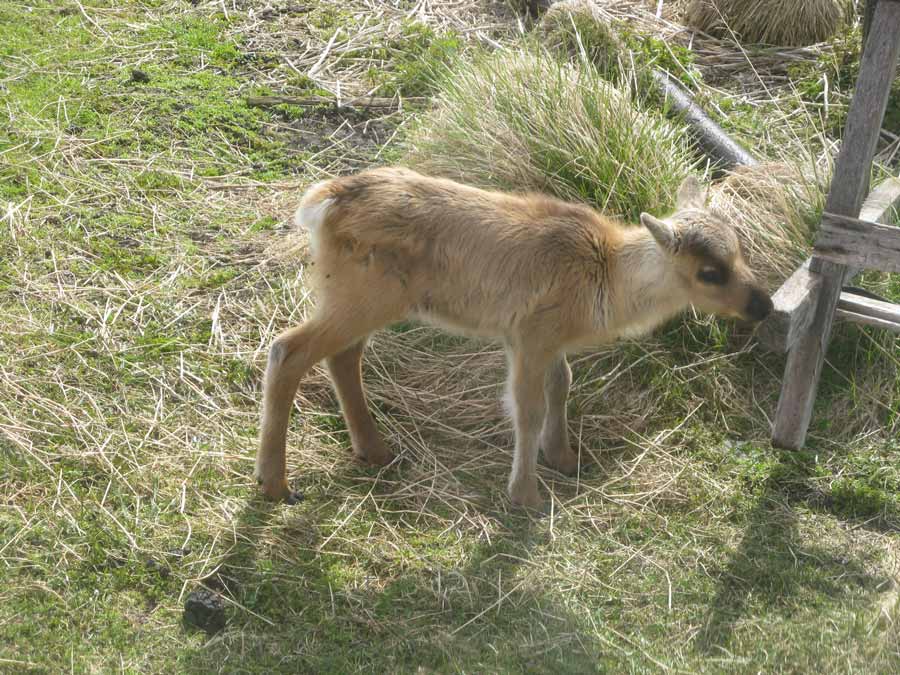
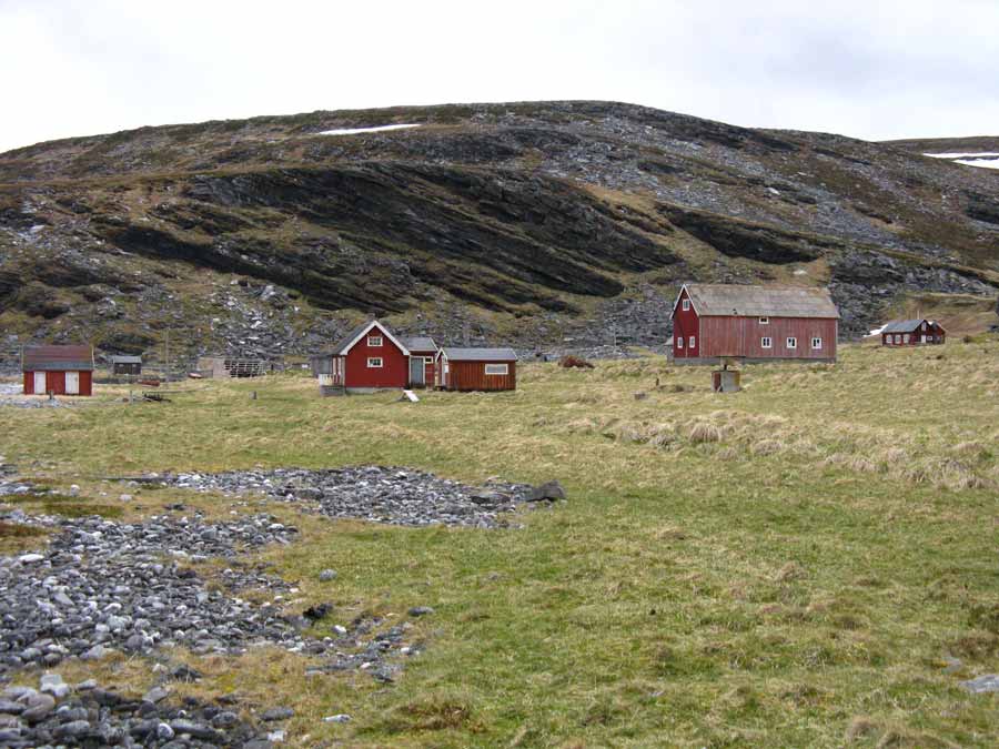 I started on the blog. Outside the window a herd of reindeer grazed with their new born calves and above me in the loft were a noisy family of thrushes. There were many thrushes here.
With the blog finished around midday the weather only showed the most minimal improvement. However it was perfectly feasible to paddle so I decided to get ready. As I did so the whole of Nordkinn peninsula changed from dark shade to bright grey sunlight. I eventually set off at 1400.
The bird colony here was mostly kittiwakes with a few shags and two sea eagles. It was not as extensive as I initially thought with a low density of birds on the huge rockface. After investigating it for a while I aimed for the distant Helnes Fyr lighthouse some 19 km away at the end of a dark peninsula. I could see the peninsula easily but not the lighthouse.
It is never pleasant crossing large open distances. The far side takes ages to approach, the weather can change and the task seems never ending. After I had gone about 5 km the weather started to deteriorate again with the wind increasing from the force three up to a good four. White horses started to appear everywhere and I was starting to get the odd faceful of spray.
In addition I suddenly realized I was right in the path of the Hurtigruten ferry when it made the crossing from Honningsvag to Kjollefjord. I still had a half hour before it should appear but it would pass nearby. There is no way it would see me, a small yellow arrow in a sea full of white horses, until it was too late.
With these two considerations I considered turning back. There was still 15 km to go which would be 3 hours minimum in this headwind. With a nervous eye to the weather from the northwest and another nervous eye on the headland to the west where the ferry would eventually appear I carried on. After a good hour the wind started to diminish to a soft force four and the number of white horses started to recede. In addition I was probably now to the north of the route the ferry would pass and it must be delayed.
Slowly but surely I pulled my way towards the dark cliffs on the south side of the peninsula. The weather was improving the whole time and I was lucky I decided to continue. When I was about 5 km from land I felt confident I would make it with any problem. There was still no sign of the Hurtigruten which was well delayed now. Soon I started to make out the individual building in the lighthouse complex.
I wanted to land here and the sea and the weather were making my job easy now. There was a small inlet on the south side and a jetty and boulder beach on the north side. I opted for the latter. The map indicated that the lighthouse might be a self service cabin in some of the old keeper’s buildings, which I found surprising but I know further south a few are. I went up to have a look with optimism.
Someone, or some group, had made a misplaced effort to turn the old keeper’s cottage into a tourist facility. One of the large sheds had been turned into a wet room and sauna, there was a hot tub in the courtyard, and the paneling on one of the buildings was being replaced. However this project looked like it had come to a halt a few years ago and the hot tub was full of debris, the sauna stunk of rot and bitumen paper was torn where the paneling was removed and not replaced. It was far too remote for anyone but die hard, self-sufficient visitors.
It was around 1900 when I was there and the wind really had dropped to a force two now, the swell was small and the sky was predominantly blue. The tide was on the way out and would not turn for three hours.
I decided to continue to Hornvika bay just before Nordkapp where I knew there was a rustic hut. I set off across the desolate Kamoyfjord to the steep headland on the other side. As I approached it a school of some 6 dolphins came towards me. After they passed under me they resurfaced with gusto and almost broke the surface. I was surprised to see them so far north.
By now the wind had dropped off to a force one, if that, and I was able to spot puffins from a few hundred metres again. The sun was blasting into my face warming it. I was in paddling paradise again.
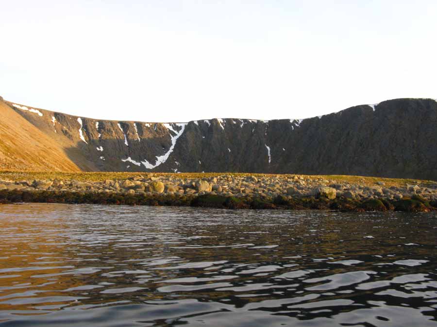 The peninsula I was passing had two large corries in it, each of which had a short valley before they met the Nordishavet sea. Each corrie was isolated by the steep mountains which surrounded it and they were only accessible from the sea where there was a lush green meadow on top of the boulder beach.
I passed the ridge on the far side of the last corries and there in front of me, standing very proud and solid was Nordkapp. It was an impressive headland rising some 300 metres straight out of the ocean. To the south of it was Hornvika bay. They were not far away and the wind now had completely disappeared and the ocean was glassy. The tide would be turning in an hour and I was 6 km from Nordkapp. Instantly I decided to go round it and skip the stop at Hornvika. The conditions were 100 percent perfect to round this infamous and notorious headland.
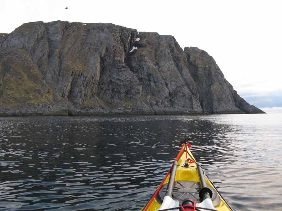 I paddled across the glassy sea towards the foot of the cliffs. I had been told to stay well out but there seem to be no reason in today’s sea. As I approached the foot of the cliffs I could see the small waves, which were less than 30 cm, gently lapping at the slabs of rock. I was lucky and very thankful I had not turned back earlier today.
I paddled right up to the base and followed it round. The cliffs were enormous and very, very imposing. Huge ridges jutted out and vast overhangs enclosed dark mysterious caverns. This was coastal architecture of immense proportions. As I paddled round the cliffs became yet more and more impressive.
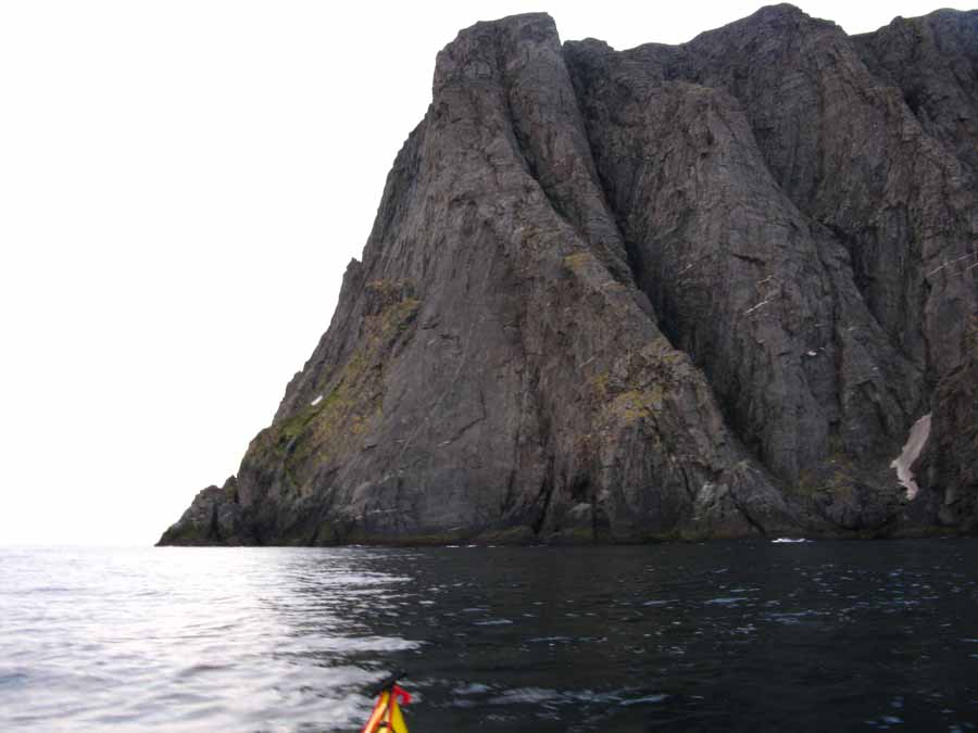 The sea began to become turbulent and choppy in places as currents well up from the depths below. It was almost sinister the way a boil would suddenly appear. This combined with the rough foot of the cliffs and the daunting slopes rising far above made this a very eerie place where I was just a miniscule and almost irrelevant spectator. These were ideal conditions and I can imagine it rough weather it would be spine chilling. It was midnight as I passed Nordkapp and the midnight sun was there but behind a dark bank of cloud long to the north.
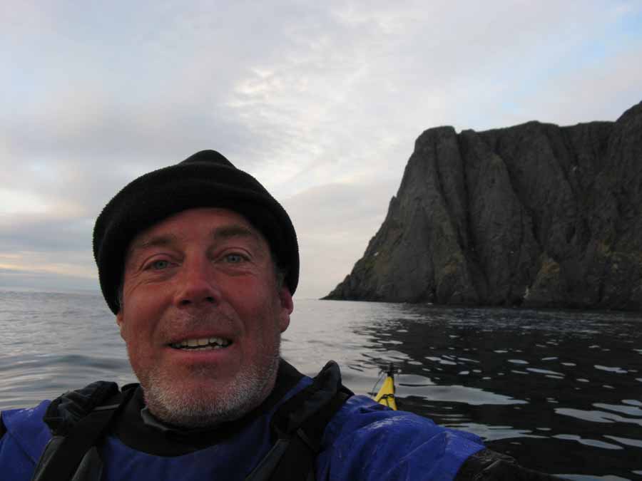 After passing Nordkapp I paddled along more cliffs with an increasing current against me until I entered the quieter waters of Knivskjellbukta bay. On the west side of this bay was another headland almost insignificant beside its massive neighbor. However this headland has the very distinguishing feature of being even further north than Nordkapp itself, and is the most northerly point of Europe, albeit on the island of Mageroy; as is Nordkapp.
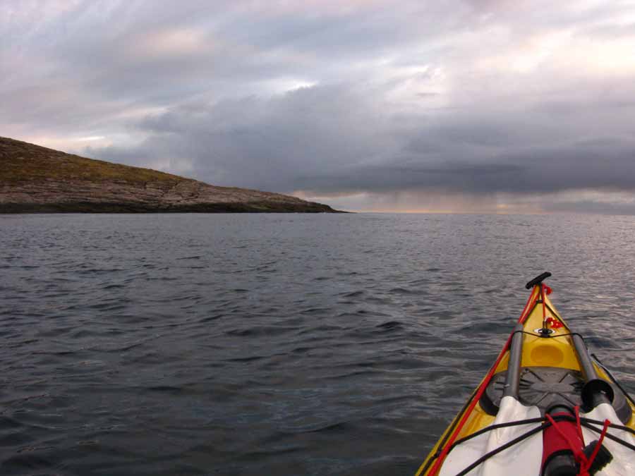 I crossed the bay and rounded the tip of this headland called Knivskjellodden. I expected the flooding tide to be sweeping round the tip but it was surprisingly quiet, although the sea was again choppy as some swell reappeared.
I was entering a different landscape now as the view to the west unfolded with every paddle stroke. There were islands appearing ahead. This was the first time I had really seen islands on this trip, except Vardo. I could also see a bay some 5 km down the rugged coast beyond Knivskjellodden which from its name I assumed had a sandy beach. It looked like there were still some snow drifts lingering in this bay beneath green pastures.
I made for the snowdrifts along the edge of the bay as the grass beyond looked idyllic to camp on. It took about an hour to reach them. About half a km from them I realized they were not snow drifts but beautiful white sand. This was an idyllic spot indeed. I sneaked between some seaweed covered skerries and then aimed for the now sunny white sand. I had the luxury of ramming the kayak up the sunny beach rather than carefully negotiating a boulder strewn shoreline. It was 0200.
I hopped out of the kayak and explored the lush meadow above the beach. There were the remains of old houses here and there and plenty of good campsites. There was a grassy slope far above which was covered in many large blackback gulls standing sentry over their nests and eggs. I put the tent up just above the beach. Just as the tent was up an isolated rain shower arrived but I was already in the tent.
I skipped supper and wriggled into my sleeping bag. Both shoulders were sore, near where the collarbone joined, and I hoped I had not done any long term damage to the tendons or cartilage, as it felt a possibility. I fell asleep as soon as I was in my bag at 0400.
It had been a fantastic day. Rounding Nordkapp in that weather was just marvelous and a bit of a relief, and to end up on this idyllic beach was the icing on the cake.