Archive for June, 2009

Day 161. Maasoy to Havoysund

Wednesday, June 10th, 2009

Distance 14km | Time 2.5hrs | Ascent 0m | Descent 0m

Day 161.1 A near perfect Robuer at Maasoy with cod drying on the jettyIt was a beautiful morning when I woke at 0800 after really too little sleep. I was falling hopelessly behind with the blog and photo updates due to this good weather and it was hanging over me. So I decided that today I would paddle the short distance to Havoysund, get a room and have a marathon writing session to catch up. It would also give me a rest.

Day 161.2 Looking out to sea past one of the jetties in the sheltered harbour of MaasoyAfter another two herring gull eggs on bread for breakfast I slowly started to gather my things and pack them. Maasoy was not the place to hurry. There was a beautiful functioning robuer still here with a jetty, where the boat would moor and unload. On the jetty was lots of fishing equipment, lots of cod hanging on racks drying and the shed where the cod was filleted and processed, long lines were baited and equipment was repaired. All the offal and waste from filleting the fish would drop into the sea beneath. Long ago the fisherman and his family would also live in these quarters with. This particular robuer was really more of a working museum than modern practicality.

Day 161.3 The stunning beach at Maasoy made the village an idyllAs I packed the kayak the men of Maasoy gathered to see me off. There was Astor, his son-in-law, his grandson and 3 others. It was a nice gesture. I shook hand with all of them then dragged my kayak across the sand into the clear waters in the bay and paddled east round the headland. I waved before I disappeared. Maasoy was a special place. In this sunny weather it was quite idyllic and the warm friendly welcome and hospitality can only really be found in such rural communities untarnished by the stresses of fast living.

There was a small kittiwake colony on the cliffs at the entrance to the harbour as I turned south and then west along the south coast of the island. The south coast itself was really quite lush with huge bunches of the succulent rock rose growing on all the ledges on the crags. There was another isolated beach here.

Day 161.4 A typical Norwegian fishing boat with the sail deployed to increase the stability and assit the engineThere was a bit of a current along the south shore in my favour and I was paddling at about 8 km an hour. A fishing boat from Havoysund passed me. He had the wind behind him and he had deployed a small sail to help him along. I also heard that this sail helped to stabilize the boat when fishing.

Day 161.5 Approaching Havoysund town with Havoy island in the middle of the photoI rounded the southern tip of the lovely Maasoy and Havoysund came into view some 12 km to the west. It was a larger town of over 1000 inhabitants built on the south shore of the small island of Havoy. Between Havoy and the mainland was a narrow sound some 300 or 400 hundred metres wide and a couple of km long. It offered a good harbour and the town developed as a fishing centre. The town was now connected to the mainland by a bridge.

On Havoy itself, apart from the town, were about 12 large wind turbines. There were a couple more but during a storm the brake mechanism failed and they spun themselves to destruction, one flying apart in a centrifugal frenzy.

I made good time across the open crossing despite the wind being against me. At one stage it was nearly a force four. There must have been a considerable tidal flow as I was still doing nearly 8 km per hour.

On my right hand side was something new and welcome. It was a large island called Hjelmsoya. Here were even a couple of islands beyond that one with the world’s most northerly lighthouse on the inhabited and remote Ingoya. Since the Russian border I have largely had the open ocean on my right and been very much at its mercy.

I arrived in Havoysund rather quickly. It was almost industrial compared to what I was used to. The fish processing operations here were on a larger scale than Kjollefjord and Mehamn. There was a small marina in the sound in front of the hotel. I pulled into that and levered the kayak onto the jetty. There were a lot of sea angling boats here which Germans and Swedes were chartering to fish cod and halibut.

Near the hotel was a quiet pensionat with cheap rooms Astor had told me about. I found it quite easily and got a lovely room at a great price. It even had a washing machine. I showered, put on a wash and then settled down to write and process the photos. Some 8 hours later after a marathon blog session I had wasted some exceptional weather but was completely up to date and my clothes were clean. The forecast was still good for a while which made me feel less guilty.

It had been a good day again. I managed a small paddle and caught up with all the paperwork.

Day 160. Tones to Maasoy

Tuesday, June 9th, 2009

Distance 30km | Time 6.5hrs | Ascent 0m | Descent 0m

I woke at 0800 with the sun beating down onto the tent and warming it so much I was overheating inside it. It was a rare problem. I had to open and tie back both ends so there was a through draught to cool me down again. I noticed an otter or mink swimming across the bay. Leaving the ends of the tent open I went back to sleep for another 4 hours until 1200. There was little hurry today after yesterday’s effort.

Day 160.1 The wonderful and idyllic beach at Tones when I camped the night after having paddled round NordkappI got up at midday, had a simple breakfast of salami and potted meat and then wandered about the meadow stretching. The many hundred blackback seagulls were still on the grass slopes high above me guarding their nests. This really was an idyllic spot. It was difficult to make the decision to leave but the weather was perfect. I carried everything down the beautiful white sand packed the kayak and pushed off at 1500 gliding over the crystal clear water with its green hue due to the white sand.

Day 160.2 Paddling towards Store Stappen bird colony from TonesI did not really have a destination but from now it was all south as I had rounded the most northern point in Europe last night. First on the list was Store Stappan. This was the largest in a rugged archipelago of rocky islands and skerries some 8 km due west. Store Stappan was a renowned bird colony and was also a Nature Reserve. It was apparently not allowed to land on the island after the 4th June so the nesting birds would not be disturbed.

There was a light following wind but a slight current against me as I crossed the open water to the largest and most northerly of this island group. I was paddling quite lazily without much strength or vigour. The sun was out and the light was strong and bright.

As I neared Store Stappan I noticed there were more and more puffins, the odd guillemot, tystie and even some razorbills. I did not see any gannets however which I thought had a colony here. Here and there were currents welling up as the tide passed over underwater skerries.

About 2 km from Store Stappan the number of puffins increased and soon there were many groups of 20 or more. As I approached they took off and joined the throng already circling around me and the kayak. Occasionally one would come close trailing it feet and turning quickly. The nearer I got to the island the more puffins took off and joined this whirlwind.

Soon I could see a vast raft of puffins on the northeast side of the island. When I was 100 metres away the whole raft of some 10,000 birds took off and started circling round me. I was amazed there were no collisions. As I approached the island I noticed more and more rafts on each side. A lot of these rafts also contained razorbills and guillemots who seemed a lot more confident and less reluctant to take to the wing.

I was quite surprised the puffins were so wary of me. A year ago I visited the Shiant Islands in the Outer Hebrides which is home to about a quarter of a million puffins. Here I could paddle right into the midst of the raft and they would lazily move out of the way at the last minute. They were a far cry from this distrustful bunch.

When I reached the northeast tip of the island I paused and started to slowly cruise south down the east side. There were kittiwakes, razorbills, guillemots and shags lining the guano covered outcrops and crags above the shore. Above this were steep grassy slopes which went up some 300 metres to the craggy ridges on top of the island. In these grassy slopes were many tens of thousands, if not hundreds of thousands, of puffin burrows. The sky was teeming with puffins flying to and fro from these burrows.

As I surveyed the slope a white flash would suddenly appear. This was a puffin with its white chest emerging from it burrow into the light of day. It would then survey the surroundings for a minute or two before launching off the slope and with a quick wing beat of tiny wings make for the sea.

Above this frantic puffin activity were at least 5 sea eagles circling above. There were no seagulls or ravens harrying them here although they must have been around. The sea eagles would have been looking for carrion, fish and dead birds. I don’t think they had the speed or agility to catch the fast puffins.

Day 160.3 The south side of Store Stappen is riddled with thousands of puffin burrowsAfter a good hour watching this birdlife I reached the southern end of the island and the close neighboring island of Kirke Stappan. There did not seem to be much bird life on this island despite it being quite similar. I paddled between the islands and continued round Store Stappan. The vast slope on the south side also seemed to be riddled with puffin burrows. I don’t know how many puffins were here but the colony seemed on a comparable scale to the Shiant Islands and there were 250,000 there.

There was a steep outcrop on the north west of the island which I did not investigate. I assumed that if there were gannets breeding here it would be on that but I did not see any circling above.

I now turned south west. With the wind behind me I decided to go to Maasoy. There seemed to be a bay on the south side of this island with a few cabins on it. It was a good 10 km across the ocean to the northeastern tip of the island. With the light wind behind me I set off. It took a couple of hours before this craggy tip was within touching distance. On the journey over I could look straight into the deep sound, called Mageroysundet, which separated Mageroy from the mainland. There seemed to be a current coming out of it in the ebbing tide.

Once at Maasoy I paddled in the shade down the east coast. In the waters here were many tystie. Tystie are usually quite solitary birds compared to their cousins the common guillemot yet they were gathered here in groups of 20. They tend to nest in crevices and cracks neared the waterline and their nests are harder to see.

Towards the south of Maasoy were two bays. As I approached I saw there were some proper houses rather than cabins here. When I rounded a large spit of rock I found myself looking into a deep sheltered bay with the spit acting as a natural breakwater. At the end of this bay was an idyllic sight

A large beach of light sand was spread across the end. Above this was a village complete with a white church and some 20 houses spread across a large pasture. As a gazed into this tranquil sight bathed in the evening sun I noticed people walking and even a car. I had not expected anyone here at all.

I paddled in, rammed the kayak up the sandy beach again and went up to the narrow road between the beach front and the spread crescent of houses. It was 2130. Just then a tractor came ambling along. I flagged it down but it was going to stop anyway. It is not every day someone comes paddling into the bay. I asked the driver, a 70 year old man called Astor, if there was anywhere to stay. Not officially he said but I am sure I can find a corner for you to sleep in. He pointed to a small homestead and told me to wander over when I had the boat up and was organized, then drove off slowly towards it.

Day 160.4 Herring gull eggs are large and tastyAfter I secured the boat and unpacked what I needed I went over. Astor welcomed me in and sat me down at the table. I could see he was a character. There was one dish I had wanted to try since I started paddling in Finnmark and I was about to be served it and that was seagulls eggs; herring gull to be precise.

The eggs were large; about twice the size of a hen’s egg. They were dark green speckled with dark spots. The shell was very thin. Inside the white was opaque and not as firm as a hen’s egg and the yolk was a bit drier and quite yellow. I ate five but which stage I was completely full. Astor told me the best eggs were tystie and puffin.

We then retired to his living room where he poured me a large Glenfiddich. He told me all about the island. There were 24 people living here. Two of them were teachers for the two pupils, one of which was his 16 year old grandson who soon joined us. There was a ferry 5 days a week and a shop owned by the community. There was a couple of fishing boats and a small processing plant here. Many of the houses were also holiday homes for people who had some family connection to the island and visited every summer at least.

He told me Svaerholt, like many places in Finnmark, was evacuated by the Germans towards the end of the war before the place was burnt. Then after the war people who had been evacuated never returned from Mid or South Norway, or only a few returned and the community was then abandoned in the 1950’s. Enough people returned to Maasoy to make it a viable community again.

Astor had recently lost his wife of some 50 years. I did not touch on the subject as it was clearly painful still. However this was a very close community and he had a daughter and grandchild here. We chatted late into the evening as the midnight sun appeared through a saddle in hills across the bay. We eventually went to bed at 0230. It was way too late for me but Astor enjoyed the company and he was a fascinating and outspoken man.

It was another superb day. Despite the late start and the long stay at the Store Stappan watching the puffins I still managed a respectable 30 km. Maasoy was a lovely place, and idyllic community in the summer and Astor was a great and interesting host.

Day 159. Svaerholt to Tones

Monday, June 8th, 2009

Distance 55km | Time 12hrs | Ascent 0m | Descent 0m

Day 159.1 A reindeer calf grazing outside the window of the barnThe weather in the morning was not quite good enough to tempt me to start paddling. In addition I needed a morning to catch up with the blog and together with the cold force three northwest wind and the occasional light sleet shower it gave me a reason to stay put and see what happened in the afternoon. The last forecast I saw was that it would improve towards the evening.

Day 159.2 The barn and other old dwellings at the abandoned community of SvaerholtI started on the blog. Outside the window a herd of reindeer grazed with their new born calves and above me in the loft were a noisy family of thrushes. There were many thrushes here.

With the blog finished around midday the weather only showed the most minimal improvement. However it was perfectly feasible to paddle so I decided to get ready. As I did so the whole of Nordkinn peninsula changed from dark shade to bright grey sunlight. I eventually set off at 1400.

The bird colony here was mostly kittiwakes with a few shags and two sea eagles. It was not as extensive as I initially thought with a low density of birds on the huge rockface. After investigating it for a while I aimed for the distant Helnes Fyr lighthouse some 19 km away at the end of a dark peninsula. I could see the peninsula easily but not the lighthouse.

It is never pleasant crossing large open distances. The far side takes ages to approach, the weather can change and the task seems never ending. After I had gone about 5 km the weather started to deteriorate again with the wind increasing from the force three up to a good four. White horses started to appear everywhere and I was starting to get the odd faceful of spray.

In addition I suddenly realized I was right in the path of the Hurtigruten ferry when it made the crossing from Honningsvag to Kjollefjord. I still had a half hour before it should appear but it would pass nearby. There is no way it would see me, a small yellow arrow in a sea full of white horses, until it was too late.

With these two considerations I considered turning back. There was still 15 km to go which would be 3 hours minimum in this headwind. With a nervous eye to the weather from the northwest and another nervous eye on the headland to the west where the ferry would eventually appear I carried on. After a good hour the wind started to diminish to a soft force four and the number of white horses started to recede. In addition I was probably now to the north of the route the ferry would pass and it must be delayed.

Slowly but surely I pulled my way towards the dark cliffs on the south side of the peninsula. The weather was improving the whole time and I was lucky I decided to continue. When I was about 5 km from land I felt confident I would make it with any problem. There was still no sign of the Hurtigruten which was well delayed now. Soon I started to make out the individual building in the lighthouse complex.

I wanted to land here and the sea and the weather were making my job easy now. There was a small inlet on the south side and a jetty and boulder beach on the north side. I opted for the latter. The map indicated that the lighthouse might be a self service cabin in some of the old keeper’s buildings, which I found surprising but I know further south a few are. I went up to have a look with optimism.

Someone, or some group, had made a misplaced effort to turn the old keeper’s cottage into a tourist facility. One of the large sheds had been turned into a wet room and sauna, there was a hot tub in the courtyard, and the paneling on one of the buildings was being replaced. However this project looked like it had come to a halt a few years ago and the hot tub was full of debris, the sauna stunk of rot and bitumen paper was torn where the paneling was removed and not replaced. It was far too remote for anyone but die hard, self-sufficient visitors.

It was around 1900 when I was there and the wind really had dropped to a force two now, the swell was small and the sky was predominantly blue. The tide was on the way out and would not turn for three hours.

I decided to continue to Hornvika bay just before Nordkapp where I knew there was a rustic hut. I set off across the desolate Kamoyfjord to the steep headland on the other side. As I approached it a school of some 6 dolphins came towards me. After they passed under me they resurfaced with gusto and almost broke the surface. I was surprised to see them so far north.

By now the wind had dropped off to a force one, if that, and I was able to spot puffins from a few hundred metres again. The sun was blasting into my face warming it. I was in paddling paradise again.

Day 159.3 One of the hidden corries on the peninsula between Helnes Fyr lighthouse and NordkappThe peninsula I was passing had two large corries in it, each of which had a short valley before they met the Nordishavet sea. Each corrie was isolated by the steep mountains which surrounded it and they were only accessible from the sea where there was a lush green meadow on top of the boulder beach.

I passed the ridge on the far side of the last corries and there in front of me, standing very proud and solid was Nordkapp. It was an impressive headland rising some 300 metres straight out of the ocean. To the south of it was Hornvika bay. They were not far away and the wind now had completely disappeared and the ocean was glassy. The tide would be turning in an hour and I was 6 km from Nordkapp. Instantly I decided to go round it and skip the stop at Hornvika. The conditions were 100 percent perfect to round this infamous and notorious headland.

Day 159.4 Approaching Nordkapp from the east around midnight on an exceptionally calm eveningI paddled across the glassy sea towards the foot of the cliffs. I had been told to stay well out but there seem to be no reason in today’s sea. As I approached the foot of the cliffs I could see the small waves, which were less than 30 cm, gently lapping at the slabs of rock. I was lucky and very thankful I had not turned back earlier today.

I paddled right up to the base and followed it round. The cliffs were enormous and very, very imposing. Huge ridges jutted out and vast overhangs enclosed dark mysterious caverns. This was coastal architecture of immense proportions. As I paddled round the cliffs became yet more and more impressive.

Day 159.5 Looking back at the 300 metre high Nordkapp having paddled round to the west sideThe sea began to become turbulent and choppy in places as currents well up from the depths below. It was almost sinister the way a boil would suddenly appear. This combined with the rough foot of the cliffs and the daunting slopes rising far above made this a very eerie place where I was just a miniscule and almost irrelevant spectator. These were ideal conditions and I can imagine it rough weather it would be spine chilling. It was midnight as I passed Nordkapp and the midnight sun was there but behind a dark bank of cloud long to the north.

Day 159.6 A self portrait with Nordkapp in the background having rounded it at midnightAfter passing Nordkapp I paddled along more cliffs with an increasing current against me until I entered the quieter waters of Knivskjellbukta bay. On the west side of this bay was another headland almost insignificant beside its massive neighbor. However this headland has the very distinguishing feature of being even further north than Nordkapp itself, and is the most northerly point of Europe, albeit on the island of Mageroy; as is Nordkapp.

Day 159.7 Approaching Knivskjellodden the most northerly point of EuropeI crossed the bay and rounded the tip of this headland called Knivskjellodden. I expected the flooding tide to be sweeping round the tip but it was surprisingly quiet, although the sea was again choppy as some swell reappeared.

I was entering a different landscape now as the view to the west unfolded with every paddle stroke. There were islands appearing ahead. This was the first time I had really seen islands on this trip, except Vardo. I could also see a bay some 5 km down the rugged coast beyond Knivskjellodden which from its name I assumed had a sandy beach. It looked like there were still some snow drifts lingering in this bay beneath green pastures.

I made for the snowdrifts along the edge of the bay as the grass beyond looked idyllic to camp on. It took about an hour to reach them. About half a km from them I realized they were not snow drifts but beautiful white sand. This was an idyllic spot indeed. I sneaked between some seaweed covered skerries and then aimed for the now sunny white sand. I had the luxury of ramming the kayak up the sunny beach rather than carefully negotiating a boulder strewn shoreline. It was 0200.

I hopped out of the kayak and explored the lush meadow above the beach. There were the remains of old houses here and there and plenty of good campsites. There was a grassy slope far above which was covered in many large blackback gulls standing sentry over their nests and eggs. I put the tent up just above the beach. Just as the tent was up an isolated rain shower arrived but I was already in the tent.

I skipped supper and wriggled into my sleeping bag. Both shoulders were sore, near where the collarbone joined, and I hoped I had not done any long term damage to the tendons or cartilage, as it felt a possibility. I fell asleep as soon as I was in my bag at 0400.

It had been a fantastic day. Rounding Nordkapp in that weather was just marvelous and a bit of a relief, and to end up on this idyllic beach was the icing on the cake.

Day 158. Kjollefjord to Svaerholt

Sunday, June 7th, 2009

Distance 27km | Time 5.5hrs | Ascent 0m | Descent 0m

Day 158.1 A tystie in KjollefjordI slept well and long and did not get up until 0930. I walked over to the hotel for the included breakfast and ate well, as it would be lunch also. The weather was bright and sunny and the skies were blue with a gentle northwest wind coming down the fjord. It would be against me but it was only force three, and it was forecast to drop.

I packed the kayak and chatted with a couple of fisherman before I cast off at 1200. The wind was still a force three as I paddled out of the mouth of the harbour. Once past the breakwater I could look down the fjord to the rock outcrops at the end known as Store Finnkjerka.

Despite the wind I made good time up the fjord at about 6 km and hour. I followed the south side which was not as barren as the north side but not far off. There was a bay, Mostadvika, half way up with a nice stream but landing looked difficult and there was no flat land for camping.

Day 158.2 Some of the very impressive rock structures on the south of Kjollefjord rise to over 300 metresAfter Mostadvika bay the south side of the fjord became more and more impressive as it grew in height to 300 metres again. The first massive outcrop was Svartberget and then the rampart of cliffs continued all the way for the 3 km to Finnkjerka. They were so high it was impossible to capture them with a camera.

Day 158.3 Finnkjerka at the southern entrance to Kjollefjord resembles a cathedralI soon approached Finnkjerka. There were in fact two structures which were unusual and one of them resembled a church, hence the name. It was only about 35 metres high however, if even that much. I stopped here to take a few photos and prepare myself for the almost 20 km crossing in the shelter of the last bay.

Day 158.4 Looking south down the coast of Nordkinn from Finnkjerka and the entrance to KjollefjordOnce I had gone past the last headland into the wide Laksefjorden I expected the wind to increase to a force four. However it was completely still with the rolling swell having a smooth glassy appearance. It was so calm I easily spotted the fins of a couple of porpoises which were gently surfacing at the headland where the currents would encourage the smaller fish they eat to gather.

Day 158.5 Looking from the the entrance to Kjollefjord across the 17 km of open ocean to the tip of Svaerholt peninsulaI looked over to the northern tip of the Svaerholt peninsula and the whole journey was under blue skies and at this instance wind still. I could not believe my luck. Svaerholt peninsula was very remote and it jutted out into the Nordishavet on its own between it more famous neighbours of Kinnarodden and Nordkapp. At the end of the Svaerholt peninsula was a large prominentary called Svaerholtklubben which was a bird colony

Just to the south of this prominentary was a bay called Svaerholtbukta. There were some old houses in the bay apparently and some good camping spots. It was my destination.

Day 158.6 Approaching Svaerholt peninsula slowly but surelyThe weather remained fantastic for the whole crossing. It was so still I could spot puffins from about 300 metres. Usually on a long crossing there is a bit of angst the weather will deteriorate badly half way across but there was no such worry today. However, as always the destination took a long time to start to get nearer, as the Nordkinn peninsula started to recede with a spectacular line of cliffs continuing south from Finnkjerka also. Nordkinn peninsula really was a complete plateau supported by these cliffs round its whole convoluted coastline.

The weather remained calm for the whole crossing but a bank of cloud was building in the north and this reached me as I reached Svaerholt. Rather than go straight into the bay where I could see the houses I detoured round to the cliffs at the bird colony first. It was a massive colony and the cliffs were plastered in kittiwakes mostly. I had seen also some guillemots and razorbills on the crossing so assumed they would be here also.

I had also seen a lot of puffins on the crossing. Puffins do not nest on ledges but in burrows or in holes beneath boulders. They also nest in colonies. Puffins are therefore much more vulnerable to predators such as weasel, stoat, mink and even fox. They have to nest in areas inaccessible to these predators such as islands or the top of sea stacks. I had seen many puffins for the last fortnight but still not spotted an area where they might be nesting.

After my reconnaissance trip to the bird colony I paddled into the bay. I did not take the kayak right up as after a rest I might want to paddle the 20 km to Helnes Fyr lighthouse on the next peninsula. It would have been criminal to waste the weather.

I ate some snacks and then started to explore. It once seemed there was a small community here. The houses could have been pre-war even too remote to have been burnt. There was a barn with living quarters attached to it, numerous small cabins, a house Norman Bates would have felt at home in and some ruined buildings along the shore. Behind all this was a small graveyard with about 8 graves all from before the war.

All the cabins and the Norman Bates style house were locked with very rusty padlocks which would be seized solid. I peered through the windows and could see peeling paint, damp mattresses and browned newspapers on the rough tables from the 1990’s. It seemed that once the community was abandoned around the war the cabins were kept as places to fish and collect eggs in the summer months. However it now seems even the cabins are abandoned.

Day 158.7 The old barn I stayed in at  the deserted settlement at SvaerholtThe barn was open and I went in. It still had the stalls for animals and a lot of old wooden barrels. The roof had a few holes in it and the doors to the hay loft upstairs had blown in. At one end was a room someone had been trying to turn into a cabin. There were 6 bunks, a table and chairs and a rusty stove. Its many windows let a lot of light in and it seemed a comfortable space. The view from the windows was marvellous. There were binoculars left here and I can think this place is sometimes visited by keen birdwatchers who visit the colony.

I was dithering to stay or not when it started to sleet and there were some gusts of wind. This was forecast to arrive. I decided to stay and carried the kayak and equipment up and secured it. I then took the necessary items to the barn. It was actually very comfortable. There was water from a brook nearby.

In the evening I wrote the blog from the Kinnarodden day. Looking out of the window I could see all the activity in the bay. An eagle was perched on a rock waiting for some carrion, and normal and golden plovers flew around the hummocks of grass. There were many thrushes nesting in the vicinity and even in the roof of the barn, and on the crags nearby where I spotted a nest with 6 eggs.

Reindeer and their newly born calves wandered around the barn oblivious to me inside and I could get a good view of them from my lookout. If I went outside they would all bolt. They were eating the grass shoots and leaving the young nettles alone.

Svaerholt also had an air of sadness to it. There must have been two or three families living here once and now it was all gone. The grass would soon claim back the graveyard and the buildings would soon collapse and be scattered by the winter storms erasing any trace of those happy summer day some 100 years ago.

It had been a very good day. The crossing was easy, the scenery was spectacular, there was plenty of birdlife and it was also interesting to explore the cultural relic at Svaerholt and spend the night in the old barn.

Day 157. Mehamn to Kjollefjord

Saturday, June 6th, 2009

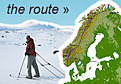
Distance 55km | Time 13hrs | Ascent 0m | Descent 0m

Day 157.1 A clearng sleet shower between Magkielspiret and KinnaroddenI got up at 0400 as I wanted to leave at 0600 to catch the tide on the way out, but most importantly before it turned at Kinnarodden. The weather was not as good as I had hoped, but the wind was only a force three.

I managed to man-handle the boat down the steep shore, pack it and then launch by 0530. I paddled out of the harbour and across Sorfjorden to the point of Smorbringa. Although there was still a considerable swell there was hardly any white caps on the waves.

From Smorbringa I headed straight across the remote Magkeilfjorden to the prominent spur of Magkeilspiret. As I paddled over the swell got bigger and there was a few more white caps. The west side of Magkeilfjorden was spectacular, remote and dropped steeply into the sea.

As I approached the far side something disturbed my head. It took a few seconds before I realized what was happening. I looked up and there was a pair of outstretched wings. A seagull had actually landed on my head and it was now perched there. I thought it was a Herring Gull so got rid of it with a hand. It flew off circled round and landed in the water beside me. It was actually a kittiwake and it looked like I had just hurt its feelings. If I knew it was a kittiwake I would have left it to travel with me for a while.

I was told there was a cabin in a sheltered inlet at the point. I had intended to stop there. However I could not see it so I continued. Just as I was about to round the point the cabin appeared. The sea around the narrow entrance inlet was very choppy with a lot of clapotis and the landing looked very rocky so I decided to carry on.

Just as I rounded Magkeilspiret things got unpleasant. The falling tide was being swept into the swell and waves arriving from the north and the sea became very choppy and confused with water hitting me in the chest. In addition a strong sleet shower arrived at the same time with increased winds. The sleet was thick and it was being driven right into my face. I could not pull my balaclava down as I had the poggies on, and I would not get them on again easily as I needed both hand on the paddle continuously. I thought rather a cold face was better than cold hands.

Day 157.2 Looking out towards KinnaroddenThe choppy confused sea only lasted for a few hundred metres but the sleet shower lasted about half an hour. It was almost snow and where I could see grassy ledges on the atmospheric cliffs above I saw they were turning white. The big swell and the sleet were not the conditions I had hoped for to go round Kinnarodden, the most northerly mainland point in Europe.

As I started to approach the tip of the peninsula however the sleet stopped and although the swell remained the sea became less confused. I could see the skerry at the foot of the cliffs. To the north of that however I thought I could see a line of breaking standing waves and I got a bit worried. As I approached closer I saw that they were just many scattered breaking crests. None the less I did not want to go through them as with this swell they were not friendly white horses but hissing white claws. I paused and watched them for a while.

There was a channel between the foot of the cliffs and the skerry. It was a narrow channel about 4 metres wide and called Avloeysinga. It was about 300 metres long. It is not possible to see the channel until you are reach it just before the tip. I was sure that in this swell the entrance and exit would be very difficult. Furthermore I did not want to go and investigate in case the falling tide swept me past the entrance round the point and into the confusion of white claws emerging from the sea.

I thought the best option was to paddle back along the coast for a km and then head out to sea for at least a km where the current would hopefully not be so strong. I did this and as I went out became aware the current was not at all strong. Eventually I saw the ocean was becoming quieter and started to head west round the north of Kinnarodden and then turned southwards.

It was then I noticed that the current was not flowing to the west but was in fact flowing north east. I knew the tide was in the last third of it ebbing but what I was experiencing was the background current of the Gulf Stream which apparently flows at 3 knots here and it was overwhelming the ebbing tidal current. It must be a fearsome flooding current here with both the tidal component and Gulf Stream combining. I was told about this and that it was best to round Kinnarodden on a falling tide.

I then paddled towards the land again and followed the coast down for some 3 km under very spectacular coastal architecture past Straumnes and Reipnakken into the entrance to Kinnarodd-Sandfjord. It was a slow choppy paddle with the swell coming steeply behind me and the Gulf Stream coming against me. I was paddling hard but only managed about 3 km per hour for this stretch. I had to give a bit extra to get round the final point into the relatively sheltered waters of the fjord.

Day 157.3 Having passed Kinnaroddenand looking south towards the headlands north of KjollefjordThe end of the fjord was a bit of a detour but I needed to get out stretch my legs and eat a bit, so decided to paddle the extra 3 km. Besides I knew what a nice beach it was having camped here the night after having completed the ski trip. There was just a small swell on this side of Kinnarodden so the surf should not too difficult.

It was a nice fast paddle into to the beach. The large amount of snow which was here over a month ago had now largely gone. There were still reindeer on the slopes surrounding the fjord.

Day 157.4 Having a break on the beach at Sandfjord with Kinnarodden in the backgroundI stopped here for a good hour while another snow shower swept in from the north and pushed the sun out of the way. The tide was just turning while I was on the beach. I found a sheltered rock and hid behind that with an eye on the kayak for half an hour until the shower was over.

Day 157.5 Looking north from Boneset with spectacular coastal architectureWith the sun now back I set off south. The coast between Sandfjord and Oxfjorden was as spectacular as anything I had seen on the trip so far. The cliffs must have come straight out of the Arctic Ocean (Nordishavet) and up for 300 metres. The strata were generally vertical so there were no ledges which kittiwakes, guillemots and razorbills like to nest on. Surprisingly I did not see any eagles here.

The current was still against me here and I made slow progress as I want past these spectacular cliffs. In addition there was still a fair swell and it was being steepened by the current and the rebounding waves were forming clapotis. There was the odd cove here but they were not at all protected. I eventually rounded a point and started to head due south into the wide entrance of Oksfjord.

Day 157.6 Another sleet shower in Oksfjorden with a shipwreck in the isolated coveGiven the sea condition there was no temptation to cut across the fjord too early, so I continued along the coast passing many more spectacular cliffs with long stretches of vertical geological strata. There must have been some incomprehensible forces at work here to tilt such huge depths of rock 90 degrees. The coves continued and in just about every one there was the twisted, rusting remnants of a large trawler or small ship. Another snow shower came through and just about obscured the near coast.

Eventually when I thought I was deep enough in the fjord to avoid the worst of the current and with only some 8 km to the other side I started to cross. There is a bird colony further in the fjord which I would miss however. The fjord itself looked very barren with steep bare rock lining both sides and no vegetation.

Slowly Kjelsvik approached. It was a nice bay and it would have made a nice camp spot. Landing would have been OK as the beach was composed of steep pebbles and was a bit protected from this swell direction. I decided to push on round the next corner, cross Kjollefjord and camp near Finnkjerka, a unique rock structure.

However the 5 km journey round the outside of this peninsula was very bumpy. The swell which had never really disappeared all day was back in force and the current here must have been strong. It was very choppy with a lot of clapotis from the rebounding waves. For nearly 2 hours the kayak was jumping from trough to crest and back to trough. It was very slow paddling and I was only doing 3 km per hour again.

I passed many more coves here but all were very exposed and barren. Most of the coves were surrounded in 300 metre high cliffs. At last the final headland appeared and as I rounded it Finnkjerka appeared on the other side of the Kjollefjord. It was much smaller than I expected, as it is a famous landmark. However the massive cliffs beside it would make most things look insignificant.

I could see from across the fjord there was nowhere to camp on the other side for a while so I followed the north coast. Here there was a steep line of cliff for 2 km until a bay. I nearly landed on the pebble beach in this bay as there was a small stream cascading down the rock, but there was nowhere to pitch a tent so I continued towards Kjollefjord.

Indeed the whole of Kjollefjord was incredibly barren. There was just no vegetation on the north side until well into the fjord. It reminded me of the barren arid landscape of Central Asia rather than lush Norway. The land here could not sustain any farming at all and it is only the sea which is productive.

I continued to hop from cove to cove looking for a camp spot until I was just 3 km from Kjollefjord. There was a good spot here but with the wind behind me I decided to continue to Kjollefjord and get a bed in the hostel. It had been a long hard day and perhaps I deserved one.

The hostel was an old fisherman’s wharf and factory. It was on its own about a km out of town. It was not what I wanted and it looked deserted. I was sure I would be the only guest. To make matters worse there was no way of landing. It was a high steep quay of large stone and broken concrete. It was not inviting so I continued to the heart of the town where there was also a beach.

I landed on the beach and soon had a very cheap room in the hotels annex nearby. It was perfect. I paddled to the sheltered inner harbour and got onto a floating jetty. A few people came over to chat. One was the off duty policewoman who helped me lift the boat onto the jetty. She was good friends with one of the couples who had done the Norge Paa Langs ski trip this year just ahead of me.

I quickly unloaded the items I needed and carried them up to the nearby annex. After a warming shower I went out. This seemed a very friendly town. Everybody stopped to chat, especially the large team of schoolchildren on their bikes. The town was about the size of Mehamn with probably around 1000 inhabitants.

I ate at the hotel. I was still swaying to and fro and lurching from side to side during the couple of hours I was at the quiet restaurant and pub. Before the food arrived I had also fallen asleep. After a nice smoked haddock it was back to the annex. There was no way I could write and I crashed out immediately.

It had been a spectacular and challenging day. I always felt I was in full control however and it was nothing like rounding Slettnes Fyr lighthouse which I have since found out is the most infamous stretches of coast in the whole Osthavet, if not North Norway. It was nice to be out of the Osthavet sea and into the Nordishavet sea as Kinnarodden is the divide.