Archive for August, 2009

Day 238. Ryvingen Fyr to Ramsoya in Lillesand

Wednesday, August 26th, 2009

Distance 52km | Time 9.5hrs | Ascent 0m | Descent 0m
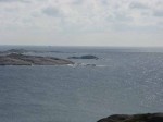
Day 238.1 The view from the top of Ryvingen Fyr lighthouse towards  the skerry of Pysen which is barely visible to the far right of the island with the cairn on itMy two roommates were well the worse for wear after the celebration dinner and evening last night but they were quiet in the room and did not disturb me much. I was up at 0800 and had a quick breakfast. However I got chatting to the group of the social workers and had a coffee with them. By then Rita and her relations were up and I had another coffee and chat with them.

I was about to leave at 1000 and Rita kindly offered to give me a guided tour of the lighthouse tower. It was quite a structure with 5 levels with the light on the fifth. The whole tower was made out of cast plates. Each plate was a bit less than a metre by two metres and must have weighed 200 kilos. Each plate was bolted to its neighbours with up to 20 bolts.

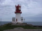
Day 238.2 The view from the top of Ryvingen Fyr lighthouse towards Lindesnes peninsula in the west above the keepers cottageThe plates were cast at Baerums verk foundry, which seemed to have done a lot of the lighthouses. The advantage with the plates is them could be transported and assembled quite easily. Apparently the tower was assembled in a couple of months at the end of the 19th century. From here there was a great view over the island and also the other islands in this archipelago. It was even possible to see the tiny skerry of Pysen, Norway’s most southerly point, some 5 km away.

After the tour Rita came down to the jetty to see me off. It was a 500 metre walk across the island to the east side where there was a sheltered bay. It was a beautiful day and it was hot in the sun down by the jetty. I said goodbye to the generous Rita and headed off at 1130.
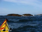
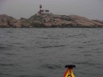
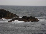
Day 238.3 The southern tip of Norway is the skerry of Pysen here with the lighthouse at Ryvingen 5 km to the west in the backgroundThere was a good force three westerly wind which blew me along nicely across the open sea for 4 km to the small Pysen. I could not see it but had to head to Odd island which had an obvious cairn on it. Once there it was easy to see Pysen. It was tiny but significant. It was a wet smooth dome of rock measuring no more than 15 metres across and only about 2 metres high. None the less it was the most southerly part of Norway.
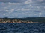
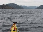
Day 238.4 The typical coast along the southern coast of Norway with pine forests here seen to the west of Ny HellesundFrom Pysen I headed north east passing Odd and entered a fantastic coast with masses of islands and skerries. The wind was pushing me along nicely and the islands stopped the waves from building up which would have slowed me down. It continued like this for a good 15 km. Some of the islands were just about bare rock while others had some sparse pine and juniper trees on them. There were goats on one island put out for summer grazing.

It really was nice paddling through these islands, especially the cluster of Uvar. The rock was pink and I assumed it was granite. There were plenty of seagulls here, mostly blackbacks. The juveniles were still whining at their parents to regurgitate some food, although most were probably able to obtain it themselves It had been a while now since I had seen a sea eagle. I think the last was north of Bergen.
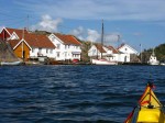
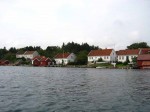
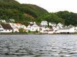
Day 238.5 The delightful hamlet of Ny Hellesund was perhaps the most beautiful I had seen along the entire coast so farAfter this island hopping I reached the islands of Monsoya and Helgoya. Between them was a small sound called Ny Hellsund which was a waterway through a hamlet. I think this hamlet was perhaps the most idyllic sight I have seen on the entire coast. Lots of little white cottages were arranged along the shore in colourful gardens. He roof tiles were all old and a rusty red with black specks where lichen was growing. Each cottage had an equally quaint boat house and jetty where there were old boats moored. It looked very old and original but I suspect it was kept that way by the people who either lived here or had cabins here. There were perhaps 30 houses in all.

The only thing out of place here was a massive cabin cruiser. This was an unsophisticated display of opulent new money amongst the more confident and modest old money who had a more cultured aesthetic awareness.

It was a joy to paddle through Ny Hellsund and every house had something of interest. However it was soon over and I left the old fishing hamlet and was once more back into the more open waters with the scattering of islands to keep the interest up and the waves down. This continued for another 6-7 km until I got to Flekkeroy island. This was really a suburb of Kristiansand and was connected by a tunnel.

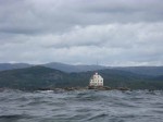
After Flekkeroy there was a fjord which was main entrance to Kristiansand. It was called Ostergapet and is entrance was guarded by two lighthouses on islets out to sea on each side of this waterway. When I arrived there were at least 40 sailing boats in this wide expanse of water enjoying the force four winds and sunshine.

I crossed over Ostergapet from Flekkeroy island to Kongshavn on the east side. As I crossed Kristiansand unfolded and then hid again as the sides of this fjord revealed and then obscured it. The south west wind which had been there all day was still helping me along.

Kongshavn seemed a mix of old fishing hamlet and modern suburb. There were about 50 new houses and 30 old ones. In tribute to the architect the new ones did fit in with the older ones both here and especially at Kvarenes a bit further on. The wind was against me slightly as I weaved through the waterways to the east of Kongshavn for a couple of km until I reached Kvasefjord. This waterway was also quite delightful but not in the same category as Ny Hellsund

There was quite a swell coming in as I crossed Kvasefjord. It was open to the south west. With the larger swell I started to wallow more and my speed dropped off as I headed to Indre Ulvoya island. The sun was starting to set now and the wind which had been a godsend all day started to drop off. I paddled through the Indresund sound and passed under a small bridge to emerge into another small archipelago of small rocky islets and larger pine clad islands with cabins on.
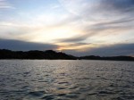
Day 238.6 The sunset as I approached the island of RamsoyaThere was still a good half hours daylight left but I thought I had better start looking from a place to camp. It would not be easy as there were many private cabins along the shore. Suddenly I saw three older houses sharing a beach and none had a light on. It was a great place to camp and as the beach was shared there would be no question of intruding. It was on the island of Ramsoya.
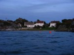
Day 238.7 Approaching the beach at Ramsoya in the very late evening where I spent the nightI paddled over, pulled up the kayak and pitched the tent as it was getting dark. All three houses were unoccupied. It was 2200 before I started supper and 2300 before I started writing. I did not finish until 0100 when there was some drizzle on the tent.

I still had some 120 km to go to relations on Aroy island in the Kragero archipelago but have decided to try and go for it in the next two days and arrive there on Friday evening for a day off to write, wash cloths and prepare for the very final section. If the weather is similar to today, Kragero should be feasible.

It had been a very good day with excellent paddling and scenery.
Day 237. Lindesnes Fyr to Ryvingen Fyr

Tuesday, August 25th, 2009

Distance 34km | Time 9.5hrs | Ascent 0m | Descent 0m 

Day 237.1 The rough seascape after leaving the sheltered inlet at Lindesnes Fyr lighthouseDespite the fact I had an early night I did not sleep that well as the wind got up a lot in the night to a good force 6. I had nostalgically camped where I did when I started this trip on 1st January and without regard to shelter of which there was virtually none. So for about 3 hours the tent rattled a lot and kept me awake. When I woke at 0800 I was not well rested. 

I got up at 0800 and looked down the inlet to the incoming waves and sea. It seemed to be a good force 5 if not force 6 and there was a lot of surf at the mouth of the inlet where the south easterly swell was crashing through. The forecast said it would ease with time. 

By 0900 it already had decreased enough for me to pack up and put my drysuit on. I then went and said good bye to the very nice staff at the lighthouse and prepared to leave. Simen who managed the visitor attractions came down to see me off and take some photos. 

It was not as bad as it looked initially and I was soon out of the inlet and into the North Sea. It was a force five and the waves were just about a metre and a half with many small breaking crests. However just after the inlet entrance the wind was forced past the headland and it was a good six for a km. I was barely moving and the waves were constantly breaking. There was not quite green water on the tops but it felt uncomfortable. The sea was also quite chaotic with clapotis everywhere. In addition to all this there were also a few submerged shoals with exploding surf erupting from them. 

This intense section only lasted for about 2 km. However this 2 km took nearly an hour until I was approaching the lee of some small islets around Vage. By now the force six at the tip of the peninsula had diminished to a force five. After a pause here I continued up the side of the peninsula for another 3 km which almost took another hour until I reached the hamlet of Gauksum, and now the wind was just a force 4. Progress was horribly slow though. 

I started heading straight into the wind over to the island of Vare. It was a slow exercise. I knew the wind was dropping and it was just a question of making a slow gain until I could penetrate it. Slowly but surely Vare approached and when I reached it I had lunch in its lee. In three hours I had gone less than 10 km. 

Day 237.2 Typical Sorlandet scenery with more gentle hills and small fjords covered in pine forestAfter lunch however the wind dropped again. I was going to go round the south of the rocky island of Hille but decided to go round the north to get more protection. I paddled across an open bay with a few islets largely of rock. To the north was the typical Sorlandet landscape of rocky outcrops covered in pine forests. There was the occasional smaller fjord cutting into these lower hills. 

It was about 6-7 km across this bay and it was a slow slog against the wind. I was hoping for the predicted change in direction but it did not come so I had to paddle head on into the force three now. When I got to Hille I had now been paddling for nearly 6 hours and only had 18 km to show for it. Still I had not been paddling hard and was not tired.

Day 237.3 The small hamlet of Hillesund stradled the sound of water witht e same nameThe north east side of Hille was lovely especially the delightful hamlet of Hillesund between Hille and the smaller island of Nakkoya. There were about 10 old white wooden cottages with old clay roof tiles and small gardens down to jetties at the water’s edge. 

I continued down the north east side and the flags beside the cabins which were snapping in the wind this morning were beginning to hang limply. I decided to go to Pysen and see if I could camp the night there. It was the most southerly part of Norway and seemed to be a small islet south of Sandoy island. However as I headed down towards it I passed through a cluster of islands and noticed how rocky they were, with little vegetation. 

It was at last nice paddling and the wind as forecast had diminished and swung to the west. Perfect for me now. I made good time through these grey barren rocky islands and soon Ryvingen Fyr lighthouse came into view. It is Norway’s most southerly lighthouse. Beyond it I could make out Sandoy island. 

As I approached Ryvingen Fyr there was some mist descending. I was also getting skeptical that there was anywhere to camp on Pysen or Sandoy as everything seemed rock. I also remember Simen at Lindesnes saying the lady who managed the keepers houses at Ryvingen Fyr would be there and would be pleased if I dropped in. 

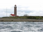
Day 237.4 Approaching Ryving Fyr lighthouse which is one of the oldest and most important on this coastI considered everything and opted for the lighthouse to avoid the potential scenario of looking for a campsite among rock slabs as darkness fell. I changed course slightly and paddled to the west side of the island it was sited on. 

There was nothing here but huge bare rock slabs. Continuing along the south side was the same. I eventually found the harbour in a deep bay on the east side of the island of 40 hectares. There was a jetty I could pull the boat onto. Just then a lady appeared. It was Rita and she had seen me coming. 

She worked for the council of Mandal who ran and maintained all but the light tower. She knew the place intimately as her father had been the last keeper here and she spent much of her childhood here. She kindly carried some stuff up for 500 metres to the keeper’s cottages. 

Mandal council hired the place out when it could and now there was a group of about 20 special needs teachers here and they were having a celebratory meal and evening at the lighthouse complex. There was a spare bunk in one of the rooms they were using. Rita also had two relations here. The teachers looked after themselves and I went up to the keeper’s cottage with Rita and here relations. We had a great evening. She knew Solvi who ran the lighthouse at Ulvesund where I stayed 4 weeks ago. 

I eventually left at 2300 and managed to write the blog before sleeping at 0100. The phone reception was too poor to bother trying to publish it. The winds tomorrow are forecast to be westerly which should help me gain some km. 

It had been a mixed day with hard paddling and little gain most of the day. In fact the paddling was almost tedious. However from Hille onwards things got better with great island landscapes. The decision to come to Ryvingen Fyr was a good one as I got a mattress and enjoyed a good evening with Rita and her relations. Norwegian hospitality is really second to none.

Day 236. Lindesnes Fyr weather and restday

Monday, August 24th, 2009

Distance 0km | Time 0hrs | Ascent 0m | Descent 0m

I woke early but the wind was rattling the tent. It was a force six and the sea was surging around the mouth of the inlet. Beyond that the sea was peppered with masses of white horses. It was as the forecast said and the forecast also said it would continue at this strength all day.

If I managed to get out of the inlet it would be hard work paddling into this wind. At the best I could hope to make 2 km per hour into this wind and it would be a hell of a slog for little gain. Indeed all I might gain would be a hernia or pulled tendon. I would not really get any shelter until I got to near Mandal some 20 km away.

Day 336.1 With Kristin Krohn Devold previously Norways defence minister and now Secretary General  of the DNTAs I was pondering the men from Lindesnes Fyr arrived. There were Simen and Ole-Jorgen who ran the museum and tourist attractions and Helge who was the lighthouse keeper and who welcomed me last night. All were very welcoming and wanted to know more about my trip. There was plenty of time to tell them in this weather.

They was also a film crew here with a group of Norwegian celebrities. One of them was Kristin Krohn Devold previously Norway’s’ defence minister and now Secretary General of the DNT. Simen introduced her and took a few photos while we chatted briefly about the outdoors.

The men from the lighthouse invited me in for a coffee and said I could use the office to write the blog. It was a perfect opportunity to catch up. I pretty much spent the rest of the morning and the entire afternoon writing and chatting with Simen and Ole-Jorgen. They were very generous and welcoming. I did indeed get everything I set out to do done.

 Lindesnes is the only lighthouse in Norway with a keeper still. The other 200 odd are all automatic now as are the 5000 beacons up and down this coast. Lindesnes was also the oldest lighthouse in Norway and dated from 1656.

Norway has an enormous amount of lighthouses considering its small population which just goes to show how significant coastal routes are here. It was much easier to go by the coast until quite recently than it was to go by road.

The wind did not really abate all day and it was sometimes quite reassuring to look out of the window onto the waves and surf knowing I had made the best choice to stay put. On the other hand I am a wee bit concerned I still have 450 km to go and only 13 days to do it in. It should be quite manageable but the blog might suffer.

Day 336.2 In the evening the wind and waves calmed down but it was to late to goJust in the evening the wind eased to a good force four and the sea state calmed down so it would have been possible to paddle for some two hours before darkness came. It was not worth getting soaked for 10 km though.

 It had been an interesting day at the lighthouse but I cannot afford many more like this if I am to reach Oslo on the 6th September.

Day 235. Jollesto in Farsund to Lindesnes Fyr

Sunday, August 23rd, 2009

Distance 41km | Time 9.5hrs | Ascent 0m | Descent 0m

Day 335.1 The huge lighthouse at Lista was built on a  large spit og bouldersWhat a difference a day makes. This morning I could hardly hear the sea when I woke and looking through the small gap in the harbour wall I could see the waves were small. I packed up the tent, dragged the kayak through the grass to the water’s edge, loaded it and set off at 0900.

It was a different world outside the harbour from yesterday. The gentle waves were barely a metre and none were breaking in the virtually still air. I made good time across the bay towards the lighthouse. The lighthouse itself was situated on a spit off the south west corner of the peninsula. This spit was moraine landscape again with small boulders and some truly massive boulders which the sea could barely move in the worst storms.

I paddled round the spit and then started heading east past the lighthouse and on to the town of Vestbygda. It was sheltering behind some massive outer breakwaters. In this main sanctuary there were also some inner breakwaters which was probably the original harbour from long ago.

Day 335.2 One of the many beautiful beaches to the east of VestbygdaAfter Vestbygda there was a glorious section of coast with many large beaches of white sand and above the sand dunes green coastal grasses before the farms started. I paddled out past a peninsula of rock outcrops and sand and reached an island called Rauna.

Rauna was full of birds and was a sanctuary with access forbidden during the nesting season. There were many geese on the island and every type of gull also seemed to be here. Skuas easily robbed the juvenile gulls of the fish they were learning to catch. It was a fascinating place ornithologically. However there was a recent storm 3 weeks ago and this had caused huge piles of rotting kelp. The place smelt foul. There were lots of insects in these rotting piles and many sandpiper type birds were feasting on them.

Day 335.3 The lighthouse at Sondre Katland has seen some hard weather in it timeAfter a pause here I continued west along the coast with its frequent beaches until I reached Loshhamn. I cut inside a couple of islets and then headed over the bay to the southern tip of Langoy island. En route I passed the lighthouse of Sondre Katland. This sat on a skerry and the lighthouse was a tower off the keeper’s accommodation. It was an important lighthouse for the shipping route to the town of Farsund. It was automatic now but when it was manned the keepers took the vegetable soil in at the end of the summer to stop it getting washed away in the storms.

From Langoy to Kjopsoy near Korshamn there was an increasing wind against me. It started at a good two and was a good force four when I reached Gronsfjord. This stretch of some 7-8 km was interspersed with a few islands so there was plenty of interest as I slogged through the waves. Sometimes they were small and other times the swell from the north sea came through and they were much larger.

Day 335.4 Leaving Kjospoy and starting to cross the Gronsfjord to Lindesnes in the distanceAt Kjopsoy there was an old community of fishing houses which were now cabins. From here it was just 5 km across Gronsfjord to Lindesnes. I set my sights on the red (possibly granite) outcrops at the end of the Lindesnes peninsula and started paddling. I could not see the lighthouse until I was quite close. By now the wind was a force 5 and the sea state was getting quite choppy especially with the clapotis of rebounding swell.

There might have been a current against me as I slowly pulled and bounced my way through the rough sea. There were many tourists at the lighthouse looking at me and pointing. Just after the lighthouse was an inlet and I paddled into it and found somewhere to land by the boatshed.

Day 335.5 Lindesnes Fyr is the only manned and oldest lighthouse in Norway from 1656I went up to the keeper’s cottage. This was the only lighthouse in Norway with a keeper still. There is a long tradition of all those who start or finish Norge Paa Langs on foot, ski, kayak or most commonly on bicycle to come here and sign the book. When I set off at new year there was no one around. The keeper welcomed me with a tea and the book and we had a chat before he had to go off and lock up.

I was a bit worried that I would get stuck in this inlet given the weather forecast with a force 6 easterly for the next two days but decided to chance it and stay here. I put up the tent in exactly in the same place as New Year. It was a bit easier to get the tent pegs in this time.

After that I went up to the lighthouse to have a look around. It was already 2030 by now. I tried to write but didn’t manage and after supper managed an early night. The tent was rattling in the wind as it was quite an exposed place.

It had been a good day. The paddling was good but the wind against me for the last 20 km made for slow progress especially the last 5 km which took well over an hour, probably nearer two in the rough sea. It was great to be back at Lindesnes after nearly 6000 km on ski and in the kayak. It would have been cause for a small celebration but I still had another 450-500 km to go to Oslo, via Stromstad, to complete the classic Norgeskyst.

Day 234. Ystebo in Sokndal to Jollesto in Farsund

Saturday, August 22nd, 2009

Distance 27km | Time 7hrs | Ascent 0m | Descent 0m

Day 334.1 Heavy rain and thunder as I made it to the sanctuary of Hidrasund soundI woke in Jan and Gunn Eide’s spare room after a wonderful sleep. I got up at 0800 and went down to a lovely breakfast. It was a typical Norwegian breakfast with a large selection of spreads to go on different breads and coffee. We chatted after breakfast also and although it was fine in the fjord I went to the breakwater to see down the fjord to the sea. There were no white horses.

I packed the kayak up and Jan and Gunn Eide saw me off at 1000. I zoomed out of the fjord and was doing nearly 10 km per hour without paddling due to the hydro electric current. At the end of the fjord I went to the east of a small island and through a 40 metre wide gap. The gap gave me a taste of what was to come as the waves here were huge; about 5 metres and reasonably steep.

Once through this gap I was out into the North Sea again. The wind was now a force four and was south westerly. It would be a side wind pretty much all the way to the island of Hidra. I kept about 500 metres out from the steep cliffs to avoid the worst of the rebounding clapotis.

The scenery here was nothing really I had seen before. The very steep, light cliffs came straight out of the dark sea as if in a dramatic painting. Here and there was some vegetation but it was mostly bare smooth rock slabs. At the base of these cliffs was a line of white surf where the large swell was smashing into the rock.

As I paddled to Hidra I noticed the south west sky was darkening. In fact it was very very dark grey. The wind was also increasing and it was soon a force 5. As I looked out to sea the sun was illuminating row upon row of white crests on top on the large swell. This looked all the brighter against the black sky which was approaching fast.

I was still about 4-5 from Hidra and needed to get there before this thunderstorm arrived. I sat up and started paddling hard. The kayak was shooting along and was launching off some of the waves. I think sometimes it was just sitting on top of a spike of water caused by the clapotis. I still had a couple of km to go when the thunderstorm arrived.

The wind was now up to a force 6, spray was everywhere and it was pouring rain. I had to lean out to sea to keep my balance as I rode up a wave and fell of the back of it into deep holes. The sea was now full of white horses and spray; which was forming streaks on the water. I was lucky none of the larger of the white horses with a bit of green water mixed in caught me.

Day 334.2 The sides of Hidrasund were steepThe whole scene was out of a Wagnerian opera. The dramatic cliffs along the coast were hazy in the rain and there was the occasional bolt of lightning and frequent rumblings of thunder. Amongst all this on a heaving sea with spray flying off the numerous white caps was a small yellow kayak heaving from crest to trough. I paddled hard for 2 km and after a quarter of an hour was at last approaching the lee of a small island to the north west of Hidra.

I decided not to go down the west side of Hidra as I probably would not make it but opted to go down the east side which was a few km longer but more sheltered. As I started the weather eased and the sun came out. I was already committed to the east side by now though.

However I soon noticed that there was a thread of water dividing Hidra into two. It started in Eie on the north side and finished at Rasvag on the south side. I found it easily and started to paddle down it. It was 4-5 metres wide and was formed into a canal by the jetties along each side. Old boat houses and fisherman’s cottages lined this canal and it was quite idyllic. It was all natural except for about 50 metres where it looked like a slot was made to link the canal on each side of the island.

I paddled south through this enchanting, deciduous passage until it opened out again and then I headed over to Rasvag for a pause before I crossed Listafjord.

Day 334.3 The charming village of Rasvag was a sorlandsidylRasvag was a Sorlands idyll. It was a small old fishing village well protected by islands. The houses were all white and well maintained, with colourful gardens. There was a café where I stopped for lunch. There was also a small shop.

Recharged by the passive waters of the canal and in the lee of the islands I had forgotten about the open sea. I was soon in it having to weave through some shoals just south of Rasvag as the surf roared onto them. The waves were soon 4 metres and the wind was force 4 again.

I was a short rough crossing where I was continually being hit in the chest by white caps. The kayak was again lurching from side to side and crest to trough. I was beginning to doubt I would get round Lista fyr lighthouse. This became every more apparent when I noticed how slowly I was going and how the wind was now a good force 5.

I slowly pulled my way down the very rough shore doing about 2.5 km per hour and using a lot of energy. The waves very large and there was plenty of clapotis and claws of white snapping sea. I decided to throw in the towel when I saw the breakwaters at Jollesto, even though it was not even 1700.

Even the last km took nearly half an hour with plenty of facefuls of water. One of the greatest irritations was the sun. I could hardly see where I was going and it was bliss when it disappeared behind a cloud and I could see the waves approaching. The final run into the harbour was quite tricky as the small bay was full of reefs with the swell erupting on them.

I eventually entered the sanctuary of the small harbour and found a campspot nearby. There is hardly any tide here now so it is much easier to move the kayak up the shoreline. The tide here is small because the tidal surge coming through the English Channel and the tidal surge coming round the north of Scotland arrive at different times and cancel each other out.

I had the tent up but 1800 and then I rinsed the salty cloths and hung them in a barely used bus shelter in the quiet village. I wrote half the blog in this shelter and half in the tent later on. It took 5 hours to get the bloody thing done and I finished at midnight.

It had been a challenging day. People have warned me about Stad, Jaeren and the exaggerated Hustadvika the whole time but nobody has ever mentioned Lista which must be just a bit less wild and exposed than Stad itself.